Download the app
educalingo
Search

Meaning of "aerial survey" in the English dictionary

Dictionary
DICTIONARY
section

PRONUNCIATION OF AERIAL SURVEY

aerial survey  [ˈɛərɪəl ˈsɜːveɪ] play
facebooktwitterpinterestwhatsapp

GRAMMATICAL CATEGORY OF AERIAL SURVEY

noun
adjective
verb
adverb
pronoun
preposition
conjunction
determiner
exclamation
Aerial survey is a noun.
A noun is a type of word the meaning of which determines reality. Nouns provide the names for all things: people, objects, sensations, feelings, etc.

WHAT DOES AERIAL SURVEY MEAN IN ENGLISH?

aerial survey

Aerial survey

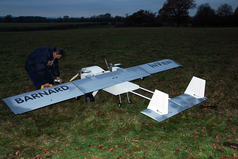
Aerial survey is a geomatics method of collecting information by using aerial photography, LiDAR or from remote sensing imagery using other bands of the electromagnetic spectrum, such as infrared, gamma, or ultraviolet. It can also refer to the chart or map made by analysing a region from the air. This is typically done using aeroplanes, helicopters, UAVs such as the InView Unmanned Aircraft System and in history with balloons. Aerial survey should be distinguished from satellite imagery technologies because of its better resolution, quality and atmospheric conditions. Today, aerial survey is often recognized as a synonym for aerophotogrammetry, part of photogrammetry where the camera is placed in the air. Measurements on aerial images are provided by photogrammetric technologies and methods. Aerial surveys can provide information on many things not visible from the ground.

Definition of aerial survey in the English dictionary

The definition of aerial survey in the dictionary is survey carried out from the air, using a plane or helicopter.

WORDS THAT RHYME WITH AERIAL SURVEY


chevet
ʃəˈveɪ
convey
kənˈveɪ
dispurvey
ˌdɪspəˈveɪ
duvet
ˈduːveɪ
inveigh
ɪnˈveɪ
Jahveh
ˈjɑːveɪ
kurvey
kɜːˈveɪ
presurvey
priːˈsɜːveɪ
purvey
pəˈveɪ
reconvey
ˌriːkənˈveɪ
releve
ˌreləˈveɪ
resurvey
ˌriːsɜːˈveɪ
Soave
ˈswɑːveɪ
suivez
ˈswiːveɪ
survey
sɜːˈveɪ
Yahveh
ˈjɑːveɪ

WORDS THAT BEGIN LIKE AERIAL SURVEY

aerial
aerial cableway
aerial camera
aerial input
aerial ladder
aerial mast
aerial perspective
aerial photograph
aerial pingpong
aerial railway
aerial root
aerial tanker
aerial top dressing
aerialist
aeriality
aerially
aerie
aeried
aeries
aerification

WORDS THAT END LIKE AERIAL SURVEY

attitude survey
damage survey
dialect survey
Garvey
Geological Survey
Harvey
jarvey
opinion survey
Ordnance Survey
sample survey
spot survey
structural survey

Synonyms and antonyms of aerial survey in the English dictionary of synonyms

SYNONYMS

Translation of «aerial survey» into 25 languages

TRANSLATOR
online translator

TRANSLATION OF AERIAL SURVEY

Find out the translation of aerial survey to 25 languages with our English multilingual translator.
The translations of aerial survey from English to other languages presented in this section have been obtained through automatic statistical translation; where the essential translation unit is the word «aerial survey» in English.

Translator English - Chinese

航测
1,325 millions of speakers

Translator English - Spanish

reconocimiento aéreo
570 millions of speakers

English

aerial survey
510 millions of speakers

Translator English - Hindi

हवाई सर्वेक्षण
380 millions of speakers
ar

Translator English - Arabic

مسح جوي
280 millions of speakers

Translator English - Russian

аэросъемка
278 millions of speakers

Translator English - Portuguese

levantamento aéreo
270 millions of speakers

Translator English - Bengali

বায়বীয় জরিপ
260 millions of speakers

Translator English - French

relevé aérien
220 millions of speakers

Translator English - Malay

Kaji selidik udara
190 millions of speakers

Translator English - German

Luftbildaufnahmen
180 millions of speakers

Translator English - Japanese

航空測量
130 millions of speakers

Translator English - Korean

공중 조사
85 millions of speakers

Translator English - Javanese

Survey aerial
85 millions of speakers
vi

Translator English - Vietnamese

khảo sát trên không
80 millions of speakers

Translator English - Tamil

வான்வழி ஆய்வு
75 millions of speakers

Translator English - Marathi

हवाई सर्वेक्षण
75 millions of speakers

Translator English - Turkish

Havadan anket
70 millions of speakers

Translator English - Italian

ricognizione aerea
65 millions of speakers

Translator English - Polish

aerofotogrametrii
50 millions of speakers

Translator English - Ukrainian

аерозйомка
40 millions of speakers

Translator English - Romanian

survol
30 millions of speakers
el

Translator English - Greek

εναέρια έρευνα
15 millions of speakers
af

Translator English - Afrikaans

lugopmeting
14 millions of speakers
sv

Translator English - Swedish

flygfotografering
10 millions of speakers
no

Translator English - Norwegian

kartlegging fra luften
5 millions of speakers

Trends of use of aerial survey

TRENDS

TENDENCIES OF USE OF THE TERM «AERIAL SURVEY»

The term «aerial survey» is regularly used and occupies the 59.089 position in our list of most widely used terms in the English dictionary.
0
100%
FREQUENCY
Regularly used
73
/100
The map shown above gives the frequency of use of the term «aerial survey» in the different countries.
Principal search tendencies and common uses of aerial survey
List of principal searches undertaken by users to access our English online dictionary and most widely used expressions with the word «aerial survey».

FREQUENCY OF USE OF THE TERM «AERIAL SURVEY» OVER TIME

The graph expresses the annual evolution of the frequency of use of the word «aerial survey» during the past 500 years. Its implementation is based on analysing how often the term «aerial survey» appears in digitalised printed sources in English between the year 1500 and the present day.

Examples of use in the English literature, quotes and news about aerial survey

EXAMPLES

10 ENGLISH BOOKS RELATING TO «AERIAL SURVEY»

Discover the use of aerial survey in the following bibliographical selection. Books relating to aerial survey and brief extracts from same to provide context of its use in English literature.
1
Digital Aerial Survey: Theory and Practice
The text includes a CD-ROM that provides Excel files that calculate mission/ photographic parameters to make the planning of an actual survey straightforward.
Ron Graham (Ph. D.), Alexander Koh, 2002
2
Manual of aerial survey: primary data acquisition
Eminently practical and authored by professionals with more than 90 years of combined experience in the field, this text covers all the essentials of aerial photography, with particular emphasis on the survey aspects of the subject.
Roger E. Read, Ron Graham, Ron Graham (Ph. D.), 2002
3
Medieval England: An Aerial Survey
This book discusses in detail some aspects of life in medieval England still to be seen in the landscape.
Maurice Warwick Beresford, John Kenneth Sinclair St. Joseph, 1979
4
Above Paris: The Aerial Survey of Roger Henrard
Maps at the beginning of each chapter further help orient the reader and together with detailed captions and essays by Jean-Louis Cohen make Above Paris a must for anybody interested in Paris or urban design.
Jean-Louis Cohen, 2006
5
Marine Mammal Survey and Assessment Methods
Keywords: Aerial survey, line transect sampling, double count, covariates, Kodiak bears, logistic detection function, Horvitz-Thompson estimates. 1 INTRODUCTION This is a continuation of our work on line transect sampling. It combines the ...
J.L Laake, D.G. Robertson, Steven C. Amstrup, 1999
6
Aerial Photography and Archaeology 2003: A Century of ...
First Results of Aerial Survey in the Eastern Part of Flanders (Belgium) Marc Lodewijckx & René Pelegrin Abstract Aerial survey by the Department of Archaeology of the University of Leuven (K.U. Leuven) began in 1997, when a joint research ...
Jean Bourgeois, Marc Meganck, 2005
7
U.S. Forest Service research note PSW.
150. STEVEN L.WERT BRUCE ROETTGERING In fall l966, we made a rapid and inexpensive aerial survey over a remote part of the Sierra National Forest, in central California. We wanted to find out if suspected outbreaks of bark beetles ...
Pacific Southwest Forest and Range Experiment Station (Berkeley, Calif.), 1967
8
A geographic information system improves aerial sketch ...
Preplanned east-west flight lines at 3 mile (4.8 kilometer) intervals were drawn on the five strips by the aerial survey observers. A Loran C navigation system and flight lines drawn on 0.5 inch to the mile (1.27 cm) National Forest Type 'A' maps  ...
A. Steven Munson, Bruce Warren Morse, William B. White, 1985
9
Aerial Survey Flight Following: Potential Improvements to ...
With the various types of aerial surveys performed by the South Carolina Forestry Commission employees, there is a need for more safety and a need to look for areas of improvement.
Laurie Reid, 2012
10
Salmonid Fisheries: Freshwater Habitat Management
A further advantage is that the aerial survey provides an extremely useful permanent record of the river conditions and character on the day of survey. The images may therefore be revisited either to confirm or to validate the habitat mapped ...
Paul Kemp, 2011

10 NEWS ITEMS WHICH INCLUDE THE TERM «AERIAL SURVEY»

Find out what the national and international press are talking about and how the term aerial survey is used in the context of the following news items.
1
Nationwide Standards Vary In Identifying, Plugging Wells
Aerial survey: Steel well casings distort the earth's magnetic field. .... to verify the results of the aerial survey and measure the amount of gas ... «Times Record, Jul 15»
2
$3 Billion Investment On The Way To Donakonda
After an overall aerial survey, the delegation inspected about 8,000 acres in and around Donakonda. Already, the AP Government identified ... «Gulte, Jul 15»
3
Lesser prairie chicken numbers up
WAFWA rushed to catch up, announcing the results of a spring aerial survey just as the firm that conducted the survey was scheduled to turn in ... «Hutchinson News, Jul 15»
4
Duck populations hitting a 60-year peak
This year's annual May-June aerial survey of those nesting grounds estimate the total population of the 10 most common ducks in the surveyed ... «Houston Chronicle, Jul 15»
5
Years Ago in the Bristol Bay Times-Dutch Harbor Fisherman
Dioroff said the central Aleutians population was particularly diminished, though the aerial survey showed sharp declines throughout the chain. Depleted or ... «Bristol Bay Times, Jul 15»
6
State angling for a big fish called Wanda
After an aerial survey, the delegation examined over 8,000 acres of land in and around Donakonda and the villages of Rudrasamudram, ... «The Hindu, Jul 15»
7
America ready to celebrate July 4th with tight security
They are able to do an aerial survey with radiological detection equipment," James Waters, chief of the NYPD's counterterrorism unit, tells CBS ... «CBS News, Jul 15»
8
Yukon's Dall sheep subject of large aerial survey
Government of Yukon biologists are conducting the latest, and largest, aerial survey of Dall sheep this month. The survey will focus on an area ... «CBC.ca, Jul 15»
9
Aerial Survey Shows Lesser Prairie Chicken Population Increased …
Cheyenne, WY -(AmmoLand.com)- An abundance of spring rainfall, along with ongoing efforts associated with the Lesser Prairie Chicken ... «AmmoLand Shooting Sports News, Jul 15»
10
New Mexico State selected for UAS dam inspection
... within Reclamation where some of our field's personnel submitted a proposal to do an aerial survey of Elephant Butte Dam,” said Klein. «UAS Magazine, Jul 15»
REFERENCE
« EDUCALINGO. Aerial survey [online]. Available <https://educalingo.com/en/dic-en/aerial-survey>. Apr 2024 ».
Download the educalingo app
en
English dictionary
Discover all that is hidden in the words on
index
a b c d e f g h i j k l m n o p q r s t u v w x y z