MIT «GEOID» VERWANDTE WÖRTER IM WÖRTERBUCH ENGLISCH
geoid
navd
ellipsoid
undulation
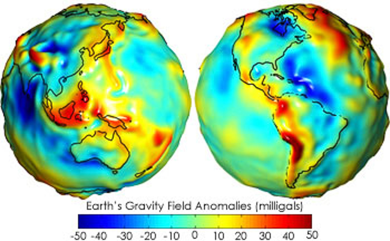
earth
shape
census
separation
that
surface
oceans
would
take
under
influence
gravitation
rotation
alone
absence
other
influences
such
winds
tides
permanent
deviation
between
mean
level
official
page
national
geodetic
survey
geoid
gravimetric
geoids
converts
heights
from
itrfxx
esri
approximates
calculated
based
hypothetical
significant
principles
geophysics
representation
assume
covered
also
equal
height
calculator
software
unavco
calculates
point
whose
latitude
longitude
specified
program
designed
interactive
landscape
creation
analysis
visualisation
developer
virtual
surveyor
biotopecreator
roadcreator
unclassified
please
view
read
enter
coordinates
press
degrees
minutes
geology
encyclopedia
britannica
model
planet
size
coincides
over
continues
define
imaginary
extension
geometric
formed
this
everywhere
10 BÜCHER, DIE MIT «GEOID» IM ZUSAMMENHANG STEHEN
Entdecke den Gebrauch von
geoid in der folgenden bibliographischen Auswahl. Bücher, die mit
geoid im Zusammenhang stehen und kurze Auszüge derselben, um seinen Gebrauch in der Literatur kontextbezogen darzustellen.
1
Gravity,
Geoid and Space Missions: GGSM 2004. IAG ...
Predicted geoid height at the Gavdos TG station from the different models and
comparisons with T/P SSHs. model can'-N' (cm) NTG (nr) 0-NTG (cm) New i14.5
16.70 :l:1.41 N“““" =l:8.6O 16.70 a=0.91 NM““°sT 112.5 16.68 :k1.19 Nhsc ..
Christopher Jekeli, Luisa M.C. Bastos, Joana Fernandes, 2006
2
Geoid and its Geophysical Interpretations
Principles and results are well illustrated. This book will be an excellent reference for geodesists, geophysicists, geophysical prospectors, oceanographers, and researchers and students in geophysics and geodesy.
Mr. Petr Vanicek, Nikolaos T. Christou, 1993
3
Applications of GPS for Surveying and Other Positioning ...
Deficiency Verticals Deficiency Local Vertical Changes Direction (relative to the
Center of the Earth) Due to Mass Anomalies FIGURE 13 Variations in geoid with
respect to the ellipsoid (5). TABLE 3 REFERENCE ELLIPSOIDS USED FOR ...
Robert J. Czerniak, James Patrick Reilly, National Cooperative Highway Research Program, 1998
4
Gravity and
geoid: joint symposium of the International ...
This volume discusses recent advances and future prospects in the exploration of the gravity field.
Hans Sünkel, Iginio Marson, International Gravity Commission, 1995
5
Glossary of Mapping Science
(2) The science which concerns itself with all aspects of the Earth's surface,
including its natural and political divisions, the distribution and differentiation of
regions, and, often, man in relation to his environment. geoid - (1) That
equipotential ...
American Society of Civil Engineers, 1994
6
Sea surface topography and the
geoid
The volume is divided into the following sections: - The Geoid - Sea Surface Topography - The Vertical Datum - Miscellaneous
Hans Sünkel, Trevor Baker, International Association of Geodesy. General Assembly, 1990
7
Fundamentals of Geophysics
This second edition of Fundamentals of Geophysics has been completely revised and updated, and is the ideal geophysics textbook for undergraduate students of geoscience with an introductory level of knowledge in physics and mathematics.
8
Geoid Determination: Theory and Methods
Regarding the different reduction methods presented in Sect.8.3 and the above
formulas as well, we can claim that the Bouguer reduction has larger indirect
effect on the geoid compared to isostatic models and Helmert's scheme (Sect. 8.4
.1).
Fernando Sansò, Michael G. Sideris, 2013
9
The Solid Earth: An Introduction to Global Geophysics
(a) - reference spheroid - geoid - equipotential gravity Figure 5.8. (a) A trough in
the geoid, or negative geoid height anomaly, occurs over a region of mass deficit
(such as a depression in the seabed). A negative free-air gravity anomaly also ...
10
Geodetic boundary value problems in view of the one ...
The book consists of contributions from leading scientists presented at an international summer school.
Fernando Sansò, Reiner Rummel, 1997
10 NACHRICHTEN, IN DENEN DER BEGRIFF «GEOID» VORKOMMT
Erfahre, worüber man in den einheimischen und internationalen Medien spricht und wie der Begriff
geoid im Kontext der folgenden Nachrichten gebraucht wird.
GPS Tip – Why don't the elevations on your maps agree with those …
... a vertical datum tied to the geoid (what we commonly call “mean sea level”). GPS elevations can disagree with map elevations by +/-400 feet. «GISuser.com, Jul 15»
Survey To Measure Exact Elevation Of Mount McKinley Under Way
Using modern GPS survey equipment and techniques, along with better gravity data to improve the geoid model in Alaska, the partners will be ... «National Parks Traveler, Jun 15»
Highest Peak in North America to be Surveyed
Using modern GPS survey equipment and techniques, along with better gravity data to improve the geoid model in Alaska, the partners will be ... «Spatial News, Jun 15»
Establishing Orthometric Heights Using GNSS — Part 1
In other words, you need to obtain a basic understanding of ellipsoid, geoid and orthometric heights and how they are related and their ... «GPS World magazine, Jun 15»
Global Mapper: A Surveyor's Perspective
It greatly facilitated my study of gravity, particularly, visualizations of the geoid, ultimately culminating in the two-part series; Gravity's Increasing ... «DirectionsMag.com, Mai 15»
LISTECH Neo 2015 is new generation geospatial software.
Plane or geodetic systems using known ellipsoids, projections, transformations and geoid models are supported. Transformations can be ... «Spatial Source, Mai 15»
Shrinking Mount Everest: How to Measure a Mountain
This creates an idealized bumpy, irregularly shaped spheroid that represents mean sea level, called a geoid, from which elevations can then ... «Live Science, Mai 15»
Blue Marble Releases the Geographic Calculator 2015 SP1 with …
Many new geodetic definitions and methods have been added to the Geographic Calculator including Geoid 12B for US, Japan Geoid Model of ... «DirectionsMag.com, Apr 15»
LISTECH Neo 2015 launched
Coordinate systems may be plane or geodetic. All coordinate systems using known ellipsoids, projections, transformations and geoid models ... «Spatial Source, Mär 15»
Global Mapper SDK v16.1 Released with Faster Display of Online …
... Rockworks XML Grid, and Carlson Grid/Geoid files. Exports to new image files using image-optimized palettes for data containing more than ... «DirectionsMag.com, Mär 15»