10 ENGLISH BOOKS RELATING TO «KONGUR SHAN»
Discover the use of
Kongur Shan in the following bibliographical selection. Books relating to
Kongur Shan and brief extracts from same to provide context of its use in English literature.
1
An Atlas of the World's Conifers: An Analysis of their ...
... surrounding the upper naryn River and into the main range of the Tian shan in
the most E part of Xinjiang. some distance s of this range are the southernmost
occurrences of P. schrenkiana near Kongur shan, a mountain 7719 m high.
Aljos Farjon, Denis Filer, 2013
2
The Finest Peaks - Prominence and Other Mountain Measures
... 8,611 Namcha Barwa Himalaya 1,500 100 4,106 7,755 Kangchenjunga
Himalaya 1,450 50 3,922 8,586 McKinley Alaskan 1,415 10 6,138 6,194 Everest
central Himalaya 1,342 30 8,850 8,850 Kongur Shan Kunlun Shan (China) 1,339
100 ...
3
The Finest Peaks: Prominence and other Mountain Measures
... 8,611 Namcha Barwa Himalaya 1,500 100 4,106 7,755 Kangchenjunga
Himalaya 1,450 50 3,922 8,586 McKinley Alaskan 1,415 10 6,138 6,194 Everest
central Himalaya 1,342 30 8,850 8,850 Kongur Shan Kunlun Shan (China) 1,339
100 ...
GI Cambodia/Laos Kongur Shan A NW China 38°39 'N 75°21 'E Kongwa
Dodoma, C Tanzania 06°13'S 36°28'E Kong, Xé see Kong, Tonlé Konia see
Konya Konibodom Rus. Kanibadam. N Tajikistan 40°16 'N 70°20 '15 Koniecpol
nad Pilica ...
5
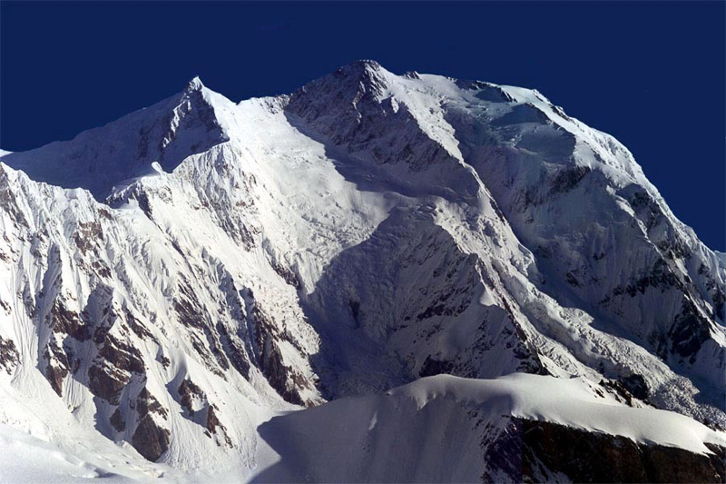
Active Faults of the World
The highest point in both the Pamirs and Tien Shan is Kongur Shan at 7710 m.
The Pamirs have also been called an indenter, a smaller scale version of the
collision of India with Eurasia. The Tarim Basin lies to the east, the Tajik
Depression ...
6
Quaternary Glaciation and Its Role on Landscape Evolution of ...
Throughout the two study regions, there are clear spatial and temporal controls on climate, topography, landform distribution and landscape evolution.
7
Tits, Nuthatches and Treecreepers
Extends into NW China in Xinjiang, in the Tien Shan mountains and eastern
Pamirs (around Kongur Shan, southwest of Kashi; Ludlow & Kinnear 1933). In
Afghanistan recorded in the northwest from the the Sauzak Kotal (northeast of
Herat) ...
8
Quaternary Glaciations - Extent and Chronology: A Closer Look
Geomorphology of anomalously high glaciated mountains at the northwestern
end of Tibet: MuztagAta and Kongur Shan. Geomorphology 103, 227–250. Shi
Yafeng, Cui Zhijiu, Su Zhen, 2006. The Quaternary Glaciations and
Environmental ...
Jurgen Ehlers, Jürgen Ehlers, Philip Leonard Gibbard, 2011
9
Paleozoic and Mesozoic tectonic evolution of central and ...
... for *Ar/39Ar geochronology: Geochimica etCosmochimicaActa, v. 61, p. 3227-
3255. Arnaud. N., Brunei. M., Cantagrel, J.M.. and Tapponnier, P., 1993, High
cooling and denudation rates at Kongur Shan (Xinjiang, China) revealed by ...
Gregory Arlen Davis, Marc S, 2001
10
Tectonic Boundary Conditions for Climate Reconstructions
Brunel, M., N. Arnaud, P. Tapponnier, Y. Pan and Y. Wang, 1994, Kongur Shan
normal fault: Type example of mountain building assisted by extension (
Karakorum fault, eastern Pamir), Geology, 22, 707-710. Brunel, M., and J. R.
Kienast, 1986 ...
Thomas J. Crowley, Kevin Burke, 1998