Undhuh app
educalingo
Golèki

Tegesé saka "Ordnance Survey" ing bausastra Basa Inggris

Bausastra
BAUSASTRA
section

PANGOCAP SAKA ORDNANCE SURVEY ING BASA INGGRIS

Ordnance Survey play
facebooktwitterpinterestwhatsapp

GOLONGAN PARAMASASTRA SAKA ORDNANCE SURVEY

tembung aran
tembung sipat
tembung kriya
tembung katrangan
tembung ganti
preposition
panyambung
panemtu
seru

APA TEGESÉ ORDNANCE SURVEY ING BASA INGGRIS?

Klik kanggo deleng deifinisi asli saka «Ordnance Survey» ing bausastra Basa Inggris.
Klik kanggo deleng pertalan otomatis saka definisi ing Basa Jawa.
Ordnance Survey

Survey Ordnance

Ordnance Survey

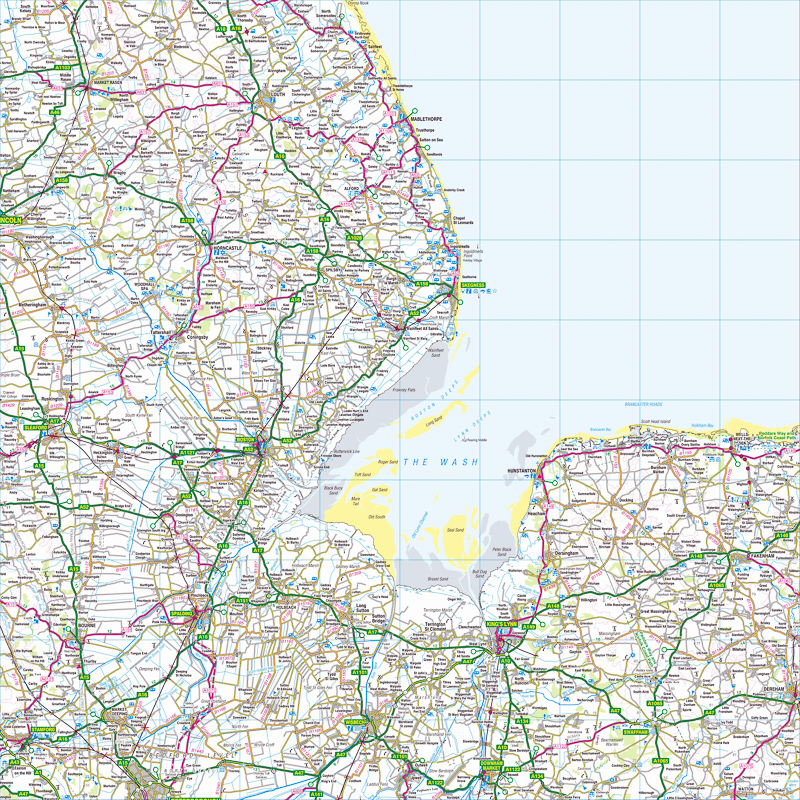
Survey Ordnance minangka agensi pemetaan nasional kanggo Britania Raya lan minangka salah sawijining prodhuk peta paling gedhe ing donya. Iki minangka departemen pamaréntahan non-menteri, badan eksekutif lan dana dagang saka Pemerintah Inggris, ing ngendi iku ana ing sangisoring pidana Departemen Bisnis, Inovasi, lan Skills. Iku uga anggota Group Data Publik. Jeneng agensi nuduhaké tujuan militèr asliné: pemetaan Skotlandia sajroning pambrontakan Jacobite taun 1745. Ana uga kebutuhan umum lan nasional sajroning ancaman potensial invasi nalika Peperangan Napoleon, sing dipirsani ing Perang Dingin Gerakan panah jurusan Departemen ing logo agensi kasebut. Pemetaan Survey Ordnance biasane diklasifikasikake minangka "skala gedhe" utawa "skala cilik". Pemetaan skala gedhe Survey kalebu peta ing enem inci kanggo mil utawa luwih lan kasedhiya minangka sheet nganti 1980-an, nalika digital. Pemetaan skala cilik dumadi saka peta sing kurang saka enem inci nganti mil, kayata peta sing luwih dhuwur tinimbang inchi kanggo peta "luang" mil lan panerus metrik. Iki isih kasedhiya ing wangun lembaran tradisional. Ordnance Survey is the national mapping agency for Great Britain and is one of the world's largest producers of maps. It is a non-ministerial government department, executive agency and trading fund of the Government of the United Kingdom, where it falls under the remit of the Department for Business, Innovation and Skills. It is also a member of the Public Data Group. The agency's name indicates its original military purpose: mapping Scotland in the wake of the Jacobite rebellion in 1745. There was also a more general and nationwide need in light of the potential threat of invasion during the Napoleonic Wars, reflected in the inclusion of the War Department's broad arrow in the agency's logo. Ordnance Survey mapping is usually classified as either "large-scale" or "small-scale". The Survey's large-scale mapping comprises maps at six inches to the mile or more and was available as sheets until the 1980s, when it was digitised. Small-scale mapping comprises maps at fewer than six inches to the mile, such as the popular one inch to the mile "leisure" maps and their metric successors. These are still available in traditional sheet form.

Definisi saka Ordnance Survey ing bausastra Basa Inggris

Définisi Ordnance Survey ing kamus iki minangka badan pembuat peta resmi saka pamaréntah Inggris utawa Irlandia.

The definition of Ordnance Survey in the dictionary is the official map-making body of the British or Irish government.

Klik kanggo deleng deifinisi asli saka «Ordnance Survey» ing bausastra Basa Inggris.
Klik kanggo deleng pertalan otomatis saka definisi ing Basa Jawa.

TEMBUNG BASA INGGRIS KANG AWIT KAYA ORDNANCE SURVEY

Ordinary National Diploma
ordinary rating
ordinary ray
ordinary seaman
ordinary shares
ordinate
ordinately
ordination
ordinee
ordnance
Ordnance Corps
ordnance datum
ordnance factory
Ordnance Survey map
ordo
ordonnance
Ordovician
ordure
ordurous
Ordzhonikidze

TEMBUNG BASA INGGRIS KANG WUSANANÉ KAYA ORDNANCE SURVEY

aerial survey
attitude survey
damage survey
dialect survey
dispurvey
Garvey
Geological Survey
Harvey
jarvey
kurvey
opinion survey
presurvey
purvey
resurvey
sample survey
spot survey
structural survey
survey

Dasanama lan kosok bali saka Ordnance Survey ing bausastra dasanama Basa Inggris

DASANAMA

Pertalan saka «Ordnance Survey» menyang 25 basa

PAMERTAL
online translator

PERTALAN SAKA ORDNANCE SURVEY

Weruhi pertalan saka Ordnance Survey menyang 25 basa nganggo Basa Inggris pamertal multi basa kita.
pertalan saka Ordnance Survey saka Basa Inggris menyang basa liyané kang kasuguhaké ing perangan iki kajupuk saka pertalan statistik otomatis; ing ngendhi inti unit pertalan yaiku tembung «Ordnance Survey» ing Basa Inggris.

Pamertal Basa Inggris - Basa Cina

地形测量
1,325 yuta pamicara

Pamertal Basa Inggris - Basa Spanyol

Ordnance Survey
570 yuta pamicara

Basa Inggris

Ordnance Survey
510 yuta pamicara

Pamertal Basa Inggris - Basa India

आयुध सर्वेक्षण
380 yuta pamicara
ar

Pamertal Basa Inggris - Basa Arab

مسح الذخائر
280 yuta pamicara

Pamertal Basa Inggris - Basa Rusia

Картографическое
278 yuta pamicara

Pamertal Basa Inggris - Basa Portugis

Ordnance Survey
270 yuta pamicara

Pamertal Basa Inggris - Basa Bengali

অর্ডিন্যান্স সার্ভে
260 yuta pamicara

Pamertal Basa Inggris - Basa Prancis

Ordnance Survey
220 yuta pamicara

Pamertal Basa Inggris - Basa Malaysia

Kajian Ordnance
190 yuta pamicara

Pamertal Basa Inggris - Basa Jerman

Landesvermessungsamt
180 yuta pamicara

Pamertal Basa Inggris - Basa Jepang

武器調査
130 yuta pamicara

Pamertal Basa Inggris - Basa Korea

병기 조사
85 yuta pamicara

Pamertal Basa Inggris - Basa Jawa

Survey Ordnance
85 yuta pamicara
vi

Pamertal Basa Inggris - Basa Vietnam

Ordnance Survey
80 yuta pamicara

Pamertal Basa Inggris - Basa Tamil

ஆர்.எஸ்.எஸ்
75 yuta pamicara

Pamertal Basa Inggris - Basa Marathi

आयुध सर्वेक्षण
75 yuta pamicara

Pamertal Basa Inggris - Basa Turki

Mücadele Anketi
70 yuta pamicara

Pamertal Basa Inggris - Basa Italia

Ordnance Survey
65 yuta pamicara

Pamertal Basa Inggris - Basa Polandia

Ordnance Survey
50 yuta pamicara

Pamertal Basa Inggris - Basa Ukrania

картографічне
40 yuta pamicara

Pamertal Basa Inggris - Basa Romawi

Ordnance Survey
30 yuta pamicara
el

Pamertal Basa Inggris - Basa Yunani

Η Ordnance Survey
15 yuta pamicara
af

Pamertal Basa Inggris - Basa Afrikaans

Ordnance Survey
14 yuta pamicara
sv

Pamertal Basa Inggris - Basa Swedia

Ordnance Survey
10 yuta pamicara
no

Pamertal Basa Inggris - Basa Norwegia

Ordnance Survey
5 yuta pamicara

Trèn migunakaké Ordnance Survey

TRÈN

KEKAREPAN PANGGUNAN ARAN «ORDNANCE SURVEY»

0
100%
ARANG KEREPÉ
Cukup akèh digunakaké
80
/100
Kart kang kapituduh ing dhuwur nuduhaké arang kerepé kagunané aran «Ordnance Survey» ing negara kang béda-béda.
Dhasar kekarepan panggolékan lan kagunaan kang umum saka Ordnance Survey
Daptar dhasar panggolékan kang dilakoni dening pangguna kanggo migunakaké Basa Inggris bausastra online kita lan gupita kang asring digunakaké nganggo tembung «Ordnance Survey».

ARANG KEREPÉ PANGGUNANÉ ARAN «ORDNANCE SURVEY» SALAWASÉ IKI

Gambar awujudaké arang kerepé evolusi taunan panggunané saka tembung «Ordnance Survey» sasuwiné 500 taun. Panggunané andedhasar panalitén sapira asringé aran «Ordnance Survey» metu ing sumber kang kacé digital ing Basa Inggris antaraning taun 1500-an lan wektu iki.

Tuladha kang kagunakaké ing sastra Basa Inggris, pethikan lan warta babaganOrdnance Survey

TULADHA

BUKU BASA INGGRIS KAKAIT KARO «ORDNANCE SURVEY»

Temukaké kagunané saka Ordnance Survey ing pilihan bibliografi iki. Buku kang kakait dening Ordnance Survey lan pethikan cekak kang padha kanggo nyediyakaké panggunané ing sastra Basa Inggris.
1
Map Of A Nation: A Biography Of The Ordnance Survey
Map of a Nation tells the story of the creation of the Ordnance Survey map – the first complete, accurate, affordable map of the British Isles.
Rachel Hewitt, 2011
2
Index to Ordnance Survey Memoirs of Ireland Series: People ...
Finally available, this is an indispensable index to the magnificent forty volume series that is the 1830-1840 Ordnance Survey Memoirs of Ireland.
Patrick McWilliams, 2002
3
Map Addict: A Tale of Obsession, Fudge and the Ordnance Survey
They are the unsung heroes of life, and this guide sings their song. There are some fine, dry tomes out there about the history and development of cartography: this is not one of them.
Mike Parker, 2010
4
Ordnance Survey: fifth report of session 2007-08, report, ...
the fact that Ordnance Survey is required to fund both its Public Task and commercial work entirely from its own revenues makes it difficult to define precisely where its public duty ends and its competition with private operations begins. l4.
Great Britain: Parliament: House of Commons: Communities and Local Government Committee, 2008
5
Ordnance Survey Memoirs of Ireland: Vol. 13: Parishes of ...
This volume contains the Memoirs for 10 parishes and granges in county Antrim, and takes us on a journey from the coastal towns of Glenarm and Carnlough up through Cushendall and the fabled Glens, inland towards Loughguile in the west, and ...
Angélique Day, Patrick McWilliams, 1992
6
Planning maps published by the Ordnance Survey on a scale of ...
Great Britain. Ordnance Survey, Great Britain. Ministry of Housing and Local Government, Great Britain. Dept. of Health for Scotland. H NOTE ON THE SERIES PLANNING MAPS These maps of Great Britain are produced in two sheets, are on ...
Great Britain. Ordnance Survey, Great Britain. Ministry of Housing and Local Government, Great Britain. Dept. of Health for Scotland, 1958
7
Ordnance Survey Memoirs of Ireland
In these new editions they act as a 19th century Domesday book and are essential to the understanding of the cultural heritage of their communities.
Angélique Day, Patrick McWilliams, 1991
8
The Irish Ordnance Survey: History, Culture and Memory
This is a cultural and intellectual history of the Ordnance Survey, which mapped Ireland from 1824 to 1846.
Gillian M. Doherty, 2006
9
Ordnance Survey Memoirs of Ireland: Vol. 15: Parishes of Co. ...
This volume contains the Memoirs for the town and extensive parish of Dungiven in the Upper Roe Valley.
Angélique Day, Patrick McWilliams, 1992
10
Ordnance Survey Memoirs of Ireland: Vol. 11: Parishes of Co. ...
This volume contains the Memoirs for the parishes of Aghanloo, Dunboe, and Magilligan, a coastal region in the lower Roe Valley of county Londonderry which includes the important seat of Down Hill.
Angélique Day, Patrick McWilliams, 1991

BABAGAN WARTA KANG NGLEBOKAKÉ ARAN «ORDNANCE SURVEY»

Weruhi yèn pawarta nasional lan internasional wis ngomongaké lan kepriyé aran Ordnance Survey digunakaké ing babagan warta iki.
1
Go walk: Kingdom come, with little effort - Crohane Mountain, Co Kerry
Map: Ordnance Survey. Discovery Series. Sheet 79. Start & finish: At the junction of a boreen and the third-class road that leads from the N22 to ... «Irish Times, Jul 15»
2
Cork's vintage 'high-status' home hits the market at €1.2m
The house dates from around 1750 and the historical Ordnance Survey maps indicate it was previously known as Malmaison. This might have ... «Irish Independent, Jul 15»
3
Minecraft: Exeter and East Devon painstakingly recreated
Inspired by the famously detailed Ordnance Survey map of Great Britain, The British Geological Society has painstakingly reproduced the ... «Exeter Express and Echo, Jul 15»
4
Josiah Mortimer :Relocation, Relocation, Relocation: Where Should …
Ordnance Survey put this point in 2000 as Lindley Hall Farm in Leicestershire, near the larger cities of Leicester and Coventry. • A touring ... «Huffington Post UK, Jul 15»
5
Fascinating tale of forgotten Thatto Heath history
After research in ordnance survey maps and press cuttings from the Liverpool mercury, he began to put together the story, of which there seemed to be little ... «St Helens Star, Jul 15»
6
Modern Artist Angela Palmer on Sculpting From Science
As for mapping, it is an area which has long captivated me, starting with ordnance survey maps in geography lessons at school. There's a ... «Inverse, Jul 15»
7
Geovation programme helps kick-start start-ups
The Geovation Programme, which runs out of Ordnance Survey's recently opened Geovation Hub, offers developers, innovators and ... «E&T magazine, Jul 15»
8
OGC seeks sponsors for FutureCities Pilot
Ordnance Survey, a Strategic Member of the OGC, has long used open standards and contributed to their development. As one of the sponsors ... «DirectionsMag.com, Jul 15»
9
North Devon recreated in Minecraft
The map is crafted using Ordnance Survey data and soil material data which has been translated into the basic Minecraft blocks including ... «North Devon Journal, Jul 15»
10
On the right path with OS Maps
Ordnance Survey has produced a new off-road sat-nav style router in its OS Maps application that covers Britain's 15 National Parks. «GISuser.com, Jul 15»
KAITAN
« EDUCALINGO. Ordnance Survey [online]. Kasedya <https://educalingo.com/jv/dic-en/ordnance-survey>. Mei 2024 ».
Undhuh app educalingo
en
Basa Inggris bausastra
Temukaké kabèh kang dhelik ing tembung ana ing
indeks
a b c d e f g h i j k l m n o p q r s t u v w x y z