Undhuh app
educalingo
Golèki

Tegesé saka "remote sensing" ing bausastra Basa Inggris

Bausastra
BAUSASTRA
section

PANGOCAP SAKA REMOTE SENSING ING BASA INGGRIS

remote sensing play
facebooktwitterpinterestwhatsapp

GOLONGAN PARAMASASTRA SAKA REMOTE SENSING

tembung aran
tembung sipat
tembung kriya
tembung katrangan
tembung ganti
preposition
panyambung
panemtu
seru

APA TEGESÉ REMOTE SENSING ING BASA INGGRIS?

Klik kanggo deleng deifinisi asli saka «remote sensing» ing bausastra Basa Inggris.
Klik kanggo deleng pertalan otomatis saka definisi ing Basa Jawa.
remote sensing

Sensing jarak jauh

Remote sensing

Sensing jarak jauh yaiku nganyari informasi babagan objek utawa fenomena tanpa nggawe kontak fisik karo obyek kasebut lan sauntara kontras karo pengamatan situ. Ing istilah modern, istilah iki umum nggunakna panggunaan teknologi sensor aerial kanggo ndeteksi lan ngelasake obyek ing Bumi (loro ing permukaan, lan ing atmosfer lan samudra) kanthi sinyal sing disebar (contone, radiasi elektromagnetik). Bisa dipérang dadi sensing remot aktif, nalika sinyal kasebut dipancaraké pisanan saka pesawat utawa satelit) utawa pasif (contone sinar srengéngé) nalika informasi direkam. Remote sensing is the acquisition of information about an object or phenomenon without making physical contact with the object and thus in contrast to in situ observation. In modern usage, the term generally refers to the use of aerial sensor technologies to detect and classify objects on Earth (both on the surface, and in the atmosphere and oceans) by means of propagated signals (e.g. electromagnetic radiation). It may be split into active remote sensing, when a signal is first emitted from aircraft or satellites) or passive (e.g. sunlight) when information is merely recorded.

Definisi saka remote sensing ing bausastra Basa Inggris

Definisi remote sensing ing kamus yaiku nggunakake instrument, kayata piranti radar utawa kamera, kanggo mindhai bumi utawa planet liya saka papan kanggo ngumpulake data babagan sawetara aspek kasebut.

The definition of remote sensing in the dictionary is the use of an instrument, such as a radar device or camera, to scan the earth or another planet from space in order to collect data about some aspect of it.

Klik kanggo deleng deifinisi asli saka «remote sensing» ing bausastra Basa Inggris.
Klik kanggo deleng pertalan otomatis saka definisi ing Basa Jawa.

TEMBUNG BASA INGGRIS KANG AWIT KAYA REMOTE SENSING

remorsefully
remorsefulness
remorseless
remorselessly
remorselessness
remortgage
remote
remote access
remote control
remote job entry
remote sensor
remote-controlled
remote-sensing
remotely
remoteness
remotion
remotivate
remotivation
remoulade
remould

TEMBUNG BASA INGGRIS KANG WUSANANÉ KAYA REMOTE SENSING

advertising
cleansing
closing
crossing
dressing
ethnic cleansing
housing
increasing
Lansing
lensing
licensing
losing
missing
nursing
passing
processing
purchasing
remote-sensing
rising
sing

Dasanama lan kosok bali saka remote sensing ing bausastra dasanama Basa Inggris

DASANAMA

Pertalan saka «remote sensing» menyang 25 basa

PAMERTAL
online translator

PERTALAN SAKA REMOTE SENSING

Weruhi pertalan saka remote sensing menyang 25 basa nganggo Basa Inggris pamertal multi basa kita.
pertalan saka remote sensing saka Basa Inggris menyang basa liyané kang kasuguhaké ing perangan iki kajupuk saka pertalan statistik otomatis; ing ngendhi inti unit pertalan yaiku tembung «remote sensing» ing Basa Inggris.

Pamertal Basa Inggris - Basa Cina

遥感
1,325 yuta pamicara

Pamertal Basa Inggris - Basa Spanyol

teledetección
570 yuta pamicara

Basa Inggris

remote sensing
510 yuta pamicara

Pamertal Basa Inggris - Basa India

रिमोट सेंसिंग
380 yuta pamicara
ar

Pamertal Basa Inggris - Basa Arab

الاستشعار عن بعد
280 yuta pamicara

Pamertal Basa Inggris - Basa Rusia

дистанционное зондирование
278 yuta pamicara

Pamertal Basa Inggris - Basa Portugis

sensoriamento remoto
270 yuta pamicara

Pamertal Basa Inggris - Basa Bengali

রিমোট সেন্সিং
260 yuta pamicara

Pamertal Basa Inggris - Basa Prancis

télédétection
220 yuta pamicara

Pamertal Basa Inggris - Basa Malaysia

Penginderaan jauh
190 yuta pamicara

Pamertal Basa Inggris - Basa Jerman

Fernerkundung
180 yuta pamicara

Pamertal Basa Inggris - Basa Jepang

リモートセンシング
130 yuta pamicara

Pamertal Basa Inggris - Basa Korea

원격 감지
85 yuta pamicara

Pamertal Basa Inggris - Basa Jawa

Remot remot
85 yuta pamicara
vi

Pamertal Basa Inggris - Basa Vietnam

viễn thám
80 yuta pamicara

Pamertal Basa Inggris - Basa Tamil

தொலை உணர்வு
75 yuta pamicara

Pamertal Basa Inggris - Basa Marathi

रिमोट सेन्सिंग
75 yuta pamicara

Pamertal Basa Inggris - Basa Turki

uzaktan Algılama
70 yuta pamicara

Pamertal Basa Inggris - Basa Italia

telerilevamento
65 yuta pamicara

Pamertal Basa Inggris - Basa Polandia

teledetekcji
50 yuta pamicara

Pamertal Basa Inggris - Basa Ukrania

дистанційне зондування
40 yuta pamicara

Pamertal Basa Inggris - Basa Romawi

teledetecție
30 yuta pamicara
el

Pamertal Basa Inggris - Basa Yunani

τηλεπισκόπηση
15 yuta pamicara
af

Pamertal Basa Inggris - Basa Afrikaans

afstandswaarneming
14 yuta pamicara
sv

Pamertal Basa Inggris - Basa Swedia

fjärranalys
10 yuta pamicara
no

Pamertal Basa Inggris - Basa Norwegia

fjernmåling
5 yuta pamicara

Trèn migunakaké remote sensing

TRÈN

KEKAREPAN PANGGUNAN ARAN «REMOTE SENSING»

0
100%
ARANG KEREPÉ
Cukup akèh digunakaké
85
/100
Kart kang kapituduh ing dhuwur nuduhaké arang kerepé kagunané aran «remote sensing» ing negara kang béda-béda.
Dhasar kekarepan panggolékan lan kagunaan kang umum saka remote sensing
Daptar dhasar panggolékan kang dilakoni dening pangguna kanggo migunakaké Basa Inggris bausastra online kita lan gupita kang asring digunakaké nganggo tembung «remote sensing».

ARANG KEREPÉ PANGGUNANÉ ARAN «REMOTE SENSING» SALAWASÉ IKI

Gambar awujudaké arang kerepé evolusi taunan panggunané saka tembung «remote sensing» sasuwiné 500 taun. Panggunané andedhasar panalitén sapira asringé aran «remote sensing» metu ing sumber kang kacé digital ing Basa Inggris antaraning taun 1500-an lan wektu iki.

Tuladha kang kagunakaké ing sastra Basa Inggris, pethikan lan warta babaganremote sensing

TULADHA

BASA INGGRIS PETHIKAN NGANGGO «REMOTE SENSING»

Pethikan lan kalimah kang moncèr nganggo tembung remote sensing.
1
Marc Garneau
Canada's a huge country, so to be able to unite the country through communication satellite technology or to be able to observe it through remote sensing technology from space is a natural fit for a country like Canada.

BUKU BASA INGGRIS KAKAIT KARO «REMOTE SENSING»

Temukaké kagunané saka remote sensing ing pilihan bibliografi iki. Buku kang kakait dening remote sensing lan pethikan cekak kang padha kanggo nyediyakaké panggunané ing sastra Basa Inggris.
1
Advanced Remote Sensing: Terrestrial Information Extraction ...
While rigorous enough for the most experienced of scientists, the techniques are well designed and integrated, making the book's content intuitive, clearly presented, and practical in its implementation. * Comprehensive overview of various ...
Shunlin Liang, Xiaowen Li, Jindi Wang, 2012
2
Introduction to Remote Sensing, Fifth Edition
A leading text for undergraduate- and graduate-level courses, this book introduces widely used forms of remote sensing imagery and their applications in plant sciences, hydrology, earth sciences, and land use analysis.
James B. Campbell, Randolph H. Wynne, 2012
3
Fundamentals of Remote Sensing
This book presents the fundamental concepts covering various stages of remote sensing from data collection to end utilization, so that it can be appreciated irrespective of the discipline in which the reader has graduated.
George Joseph, 2005
4
Remote Sensing: Models and Methods for Image Processing
Remote sensing is a technology that engages electromagnetic sensors to measure and monitor changes in the earth’s surface and atmosphere. Normally this is accomplished through the use of a satellite or aircraft.
Robert A. Schowengerdt, 2006
5
Urban Remote Sensing
Organized into five sections, this book: Focuses on data, sensors, and systems considerations as well as algorithms for urban feature extraction Analyzes urban landscapes in terms of composition and structure, especially using sub-pixel ...
Qihao Weng, Dale A. Quattrochi, 2006
6
An Introduction to Ocean Remote Sensing
The book covers radiative transfer, ocean surface properties, satellite orbits, instruments and methods, visible remote sensing of biological properties, infrared sea surface temperature retrieval, passive microwave measurements, ...
Seelye Martin, 2004
7
Field Methods in Remote Sensing
In contrast, this book provides clear recommendations for defining field work objectives, devising a valid sampling plan, finding locations using GPS, and selecting and using effective measurement techniques for field reflectance spectra ...
Roger M. McCoy, 2005
8
Integration of GIS and Remote Sensing
This book is an invaluable reference for students and professionals dealing not only with GIS and remote sensing, but also computer science, civil engineering, environmental science and urban planning within the academic, governmental and ...
Victor Mesev, 2008
9
Advances in Environmental Remote Sensing: Sensors, ...
An authoritative text, Advances in Environmental Remote Sensing: Sensors, Algorithms, and Applications compiles comprehensive review articles to examine the developments in concepts, methods, techniques, and applications as well as focused ...
Qihao Weng, 2011
10
Remote Sensing : The Image Chain Approach: The Image Chain ...
For this second edition, in addition to a thorough update, there are major changes and additions, such as a much more complete treatment of spectroscopic imaging, which has matured dramatically in the last ten years, and a more rigorous ...
Digital Image and Remote Sensing Laboratory Rochester Institute of Technology John R. Schott Professor of Imaging Science and Director, 2007

BABAGAN WARTA KANG NGLEBOKAKÉ ARAN «REMOTE SENSING»

Weruhi yèn pawarta nasional lan internasional wis ngomongaké lan kepriyé aran remote sensing digunakaké ing babagan warta iki.
1
New remote sensing facility launched in Bangaluru
Bangaluru: Karnataka Chief Minister Siddaramaiah inaugurated the new Karnataka State Remote Sensing Applications Centre (KSRSAC) facility on Thursday at ... «Zee News, Jun 15»
2
Delhi government to use remote sensing technology to check illegal …
NEW DELHI: Delhi government today said it will use remote sensing satellite technology to check and map unauthorised constructions and encroachments in ... «Economic Times, Mei 15»
3
Half Empty ep.5: Remote sensing monitors wetland fluctuations
By observation and analysis with satellite and remote sensing, we identify wetland problems,” said professor Chen Xiaoling, State Key Lab (LIESMARS), Wuhan ... «CCTV, Mei 15»
4
DigitalGlobe Supports Updated Commercial Remote Sensing
The Commercial Remote Sensing Act of 2015 is an important step toward necessary regulatory reform that will encourage growth in the U.S. commercial remote ... «Space Ref, Mei 15»
5
Project concepts presented for Remote Sensing Applications …
More than 20 concepts for projects in remote sensing and space science have been presented to the Emirates Institution for Advanced Science and Technology ... «The National, Apr 15»
6
Xactware Introduces Remote Sensing Lab
SALT LAKE CITY, Feb. 10, 2015 (GLOBE NEWSWIRE) -- Today, at its sixth annual user conference, Xactware announced the Xactware Remote Sensing Lab, ... «GlobeNewswire, Feb 15»
7
Raytheon acquires remote sensing, UAS tech company
Sensintel, headquartered in Arizona, was a privately held company specializing in expendable remote sensing and UAS engineering for intelligence and ... «UPI.com, Jan 15»
8
Research and Markets: Journal of Remote Sensing & GIS (JoRSG)
Journal of Remote Sensing & GIS (JoRSG) is a print and e-journal which contains good quality- original research papers, review papers, short communications ... «Business Wire, Jan 15»
9
China successfully launches Yaogan-24 remote sensing satellite
Beijing: China on Thursday successfully launched a remote sensing satellite into a scheduled orbit at 3:12 pm from the Jiuquan Satellite Launch Centre in ... «Zee News, Nov 14»
10
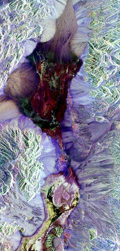
Ten ways remote sensing can contribute to conservation
A remote sensing image of Yellowstone National Park, regarded by many as the world's first national park. WCS, NASA, And other conservation and remote ... «Phys.Org, Nov 14»

KAITAN
« EDUCALINGO. Remote sensing [online]. Kasedya <https://educalingo.com/jv/dic-en/remote-sensing>. Mei 2024 ».
Undhuh app educalingo
en
Basa Inggris bausastra
Temukaké kabèh kang dhelik ing tembung ana ing
indeks
a b c d e f g h i j k l m n o p q r s t u v w x y z