앱 다운로드
educalingo
검색

영어 사전에서 "Ordnance Survey map" 뜻

사전
사전
section

영어 에서 ORDNANCE SURVEY MAP 의 발음

Ordnance Survey map  [ˈɔːdnəns ˈsɜːveɪ mæp] play
facebooktwitterpinterestwhatsapp

ORDNANCE SURVEY MAP의 문법 범주

명사
형용사
동사
부사
대명사
전치사
접속사
한정사
감탄사

영어에서 ORDNANCE SURVEY MAP 의 뜻은 무엇인가요?

영어 사전에서 «Ordnance Survey map» 의 원래 정의 보기를 원하면 클릭하세요
한국어 사전에서 자동 번역 보기를 원하면 클릭하세요
Ordnance Survey map

병기 설문 조사

Ordnance Survey

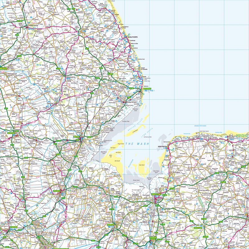
Ordnance Survey는 영국의 국립지도 대행사로, 세계에서 가장 큰지도 제작자 중 하나입니다. 영국 정부의 비영리 정부 부처, 집행 기관 및 무역 기금으로, 비즈니스, 혁신 및 기술 부서의 임무를받습니다. 또한 Public Data Group의 멤버이기도합니다. 기관의 이름은 원래 군사 목적을 나타냅니다 : 스코틀랜드 매핑 자코 바이트 반란의 결과로 1745. 나폴레옹 전쟁 동안 침공의 잠재적 인 위협에 비추어 볼 때,보다 일반적이며 전국적인 필요성이 전쟁의 포함에 반영되었습니다 기관의 로고에있는 부서의 광범위한 화살표 병기 검사 맵핑은 일반적으로 "대규모"또는 "소규모"로 분류됩니다. Survey의 대규모 매핑은 6 인치에서 1 마일 이상 거리의지도로 구성되며 디지털화 된 1980 년대까지는 시트로 제공되었습니다. 소규모 매핑은 인기있는 1 인치에서 마일의 "여가"지도와 메트릭 후속 모델과 같이 마일까지 6 인치 미만의지도로 구성됩니다. 이들은 여전히 ​​전통적인 시트 형태로 이용 가능합니다. Ordnance Survey is the national mapping agency for Great Britain and is one of the world's largest producers of maps. It is a non-ministerial government department, executive agency and trading fund of the Government of the United Kingdom, where it falls under the remit of the Department for Business, Innovation and Skills. It is also a member of the Public Data Group. The agency's name indicates its original military purpose: mapping Scotland in the wake of the Jacobite rebellion in 1745. There was also a more general and nationwide need in light of the potential threat of invasion during the Napoleonic Wars, reflected in the inclusion of the War Department's broad arrow in the agency's logo. Ordnance Survey mapping is usually classified as either "large-scale" or "small-scale". The Survey's large-scale mapping comprises maps at six inches to the mile or more and was available as sheets until the 1980s, when it was digitised. Small-scale mapping comprises maps at fewer than six inches to the mile, such as the popular one inch to the mile "leisure" maps and their metric successors. These are still available in traditional sheet form.

영어 사전에서 Ordnance Survey map 의 정의

사전에있는 병기 조사지도의 정의는 영국에있는 한 지역의 공식 지형도입니다.

The definition of Ordnance Survey map in the dictionary is an official topographical map of an area in the United Kingdom.

영어 사전에서 «Ordnance Survey map» 의 원래 정의 보기를 원하면 클릭하세요
한국어 사전에서 자동 번역 보기를 원하면 클릭하세요

ORDNANCE SURVEY MAP 운과 맞는 영어 단어


bitmap
ˈbɪtˌmæp
IMAP
ˈaɪˌmæp
map
mæp
photomap
ˈfəʊtəʊˌmæp
remap
riːˈmæp

ORDNANCE SURVEY MAP 처럼 시작하는 영어 단어

Ordinary National Diploma
ordinary rating
ordinary ray
ordinary seaman
ordinary shares
ordinate
ordinately
ordination
ordinee
ordnance
Ordnance Corps
ordnance datum
ordnance factory
Ordnance Survey
ordo
ordonnance
Ordovician
ordure
ordurous
Ordzhonikidze

ORDNANCE SURVEY MAP 처럼 끝나는 영어 단어

chromosome map
cognitive map
contour map
digital map
electoral map
genetic map
grid map
mud map
off the map
outline map
put on the map
relief map
road map
route map
site map
skeleton map
sketch map
street map
weather map

영어 사전에서 Ordnance Survey map 의 동의어와 반의어

동의어

25개국어로 «Ordnance Survey map» 번역

번역기
online translator

ORDNANCE SURVEY MAP 의 번역

영어 다중 언어 번역기 를 사용해 Ordnance Survey map25개국어 번역을 확인해보세요
자동 통계기반 번역을 통해 영어 에서 이 항목에 표시된 다른 언어로 Ordnance Survey map 번역 이 이루어집니다. 이 항목의 기본적인 번역 단위는 영어 단어 «Ordnance Survey map» 입니다.

영어 - 중국어 번역기

全国地形测量局地图
화자 1,325 x 백만 명

영어 - 스페인어 번역기

Artillería mapa Encuesta
화자 570 x 백만 명

영어

Ordnance Survey map
화자 510 x 백만 명

영어 - 힌디어 번역기

आयुध सर्वेक्षण नक्शा
화자 380 x 백만 명
ar

영어 - 아랍어 번역기

الذخائر خريطة المسح
화자 280 x 백만 명

영어 - 러시아어 번역기

Картографическое карте
화자 278 x 백만 명

영어 - 포르투갈어 번역기

Ordnance mapa Levantamento
화자 270 x 백만 명

영어 - 벵골어 번역기

অর্ডিন্যান্স সার্ভে মানচিত্র
화자 260 x 백만 명

영어 - 프랑스어 번역기

Ordnance Survey carte
화자 220 x 백만 명

영어 - 말레이어 번역기

Peta Ukur Ordnance
화자 190 x 백만 명

영어 - 독일어 번역기

Messtischblatt
화자 180 x 백만 명

영어 - 일본어 번역기

兵器調査マップ
화자 130 x 백만 명

영어 - 한국어 번역기

병기 조사 지도
화자 85 x 백만 명

영어 - 자바어 번역기

Peta Survey Ordnance
화자 85 x 백만 명
vi

영어 - 베트남어 번역기

Bản đồ khảo sát bom mìn
화자 80 x 백만 명

영어 - 타밀어 번역기

ஆர்.எஸ்.எஸ்
화자 75 x 백만 명

영어 - 마라티어 번역기

आयुध सर्वेक्षण नकाशा
화자 75 x 백만 명

영어 - 터키어 번역기

Donanma Anketi haritası
화자 70 x 백만 명

영어 - 이탈리아어 번역기

Ordnance Survey mappa
화자 65 x 백만 명

영어 - 폴란드어 번역기

Ordnance Survey mapie
화자 50 x 백만 명

영어 - 우크라이나어 번역기

Картографічне мапі
화자 40 x 백만 명

영어 - 루마니아어 번역기

Ordnance harta Sondaj
화자 30 x 백만 명
el

영어 - 그리스어 번역기

Ordnance Survey χάρτη
화자 15 x 백만 명
af

영어 - 아프리칸스어 번역기

Ordnance Survey kaart
화자 14 x 백만 명
sv

영어 - 스웨덴어 번역기

Ordnance Survey karta
화자 10 x 백만 명
no

영어 - 노르웨이어 번역기

Ordnance Survey kartet
화자 5 x 백만 명

Ordnance Survey map 의 사용 경향

경향

«ORDNANCE SURVEY MAP» 의 용어 사용 경향

0
100%
빈도
자주 사용됨
69
/100
위의 지도는 다른 국가에서 «Ordnance Survey map» 의 사용 빈도를 나타냅니다.
Ordnance Survey map 의 주요 검색 경향 및 일반적인 사용
사용자가 영어 온라인 사전 에 접속하기 위해 주로 사용한 검색 목록과 «Ordnance Survey map» 단어와 가장 널리 사용되는 표현입니다.

시간 경과에 따른 «ORDNANCE SURVEY MAP» 의 사용 빈도

지난 500년간 «Ordnance Survey map» 의 연간 사용 빈도의 변화 를 나타내는 그래프입니다. 1500년과 현재 날짜 사이에 영어 «Ordnance Survey map» 단어가 디지털화된 인쇄물에 얼마나 자주 표시되는지 분석하여 구현합니다.

Ordnance Survey map 에 대한 영어 문헌, 인용문 및 뉴스에서 사용된 사례

예시

«ORDNANCE SURVEY MAP» 관련 영어 책

다음 도서 목록 항목에서 Ordnance Survey map 의 용법을 확인하세요. Ordnance Survey map 에 관련된 책과 해당 책의 짧은 발췌문을 통해 영어 서적에서 단어가 사용되는 맥락을 제공합니다.
1
Map Of A Nation: A Biography Of The Ordnance Survey
Map of a Nation tells the story of the creation of the Ordnance Survey map – the first complete, accurate, affordable map of the British Isles.
Rachel Hewitt, 2011
2
Geographical Enquiries: Skills and Techniques for Geography
1.1 Ordnance Survey map of Otmoor (1 :50,000) Most Ordnance Survey maps that are used are either at a 1:50,000 or a 1:25,000 scale. On a 1:50,000 map 1cm on the map relates to 50,000cm on the ground. On a 1:25,000 map every 1cm on ...
Garrett Nagle, Kris Spencer, 2000
3
Townlands in Ulster: Local History Studies
THE IMPORTANCE OF MAPS In this investigation our starting date should be the present and we should begin with a close and thorough examination of the district using first the latest edition of the Ordnance Survey map and then the Revised ...
W. H. Crawford, R. H. Foy, 1998
4
Geological Maps: Their Solution and Interpretation
031 557 3011. The Ordnance Survey Map Catalogue is available from: Ordnance Survey, Romsey Road, Southampton S09 4DH. Tel. 0703 792398 or 792416. example on Map 3 the symbols indicate that all the subdivisions present belong to ...
T. Bolton, 1989
5
Geographic Information Management in Local Government
Aerial photgraphy provides high-quality aerial photographs, an integral part of the Ordnance Survey map revision system. • Landplan is the map of choice for site location, farm or estate management, and identifying land use at 1:10,000 scale.
Ian Gilfoyle, Peter Thorpe, 2004
6
Survey of Medieval Winchester
The prime cartographic source for this present Survey has been the Ordnance Survey Map at 1:500 scale surveyed in 1869-71 and probably first published during the two years following the completion of the survey (Frontispiece II b).s This ...
Derek Keene, Alexander R. Rumble, 1985
7
The Woodland Heritage Manual
Without knowing where a certain earthwork or area of coppice wood is located, it cannot be managed and preserved. Grid references can be derived in several ways. • Directly from an Ordnance Survey map if the feature has already been ...
Ian D. Rotherham, Melvyn Jones, Lindy Smith, 2011
8
na
Ordnance Survey map Ordnance Survey maps are accepted for registration only in cases where such maps are the current edition of the largest scale published. Dimensioned plans of large-scale surveys are accepted for registration only in ...
9
World Mapping Today
The 1:50 000 and 1:25 000 scale topographic maps are available from Ordnance Survey map agents in the UK and from LSD, Grand Cayman, while digital maps in hard copy or on disk, CD-ROM or tape may also be purchased from the latter.
Bob Parry, Chris Perkins, 2000
10
Headingley: 'this Pleasant Rural Village' ; Clues to the Past
1850: Ordnance Survey Map (surveyed 1847) (6 inches to the mile). 1890: Large Scale (10feettothe mile) Ordnance Survey Town Map (surveyed 1889) –sheets in the CCIII13 series cover parts of Headingley. 1893: Ordnance Survey Map ...
Eveleigh Bradford, 2008

«ORDNANCE SURVEY MAP» 단어를 포함하는 뉴스 기사

다음 뉴스 기사의 맥락에서 국내 및 국제 언론이 말하는 내용 및 Ordnance Survey map 단어를 사용하는 방법을 알아보세요.
1
Minecraft: Exeter and East Devon painstakingly recreated
Inspired by the famously detailed Ordnance Survey map of Great Britain, The British Geological Society has painstakingly reproduced the ... «Exeter Express and Echo, 7월 15»
2
From the BT Tower to Lyons Corner Houses, a lament for lost …
... was an official secret, and therefore appeared on no Ordnance Survey map for all that it was 191 metres high and built of concrete and steel. «The Guardian, 7월 15»
3
Council launches 'adopt a path' scheme in Burnham-On-Sea area
Anyone can get involved in the project. You can check if a route you wish to adopt is a public right of way by checking an Ordnance Survey map ... «Burnham-On-Sea, 7월 15»
4
Walkers guide helicopter to injured friend
The group were well prepared and were able to give a good location using an Ordnance Survey map reference and visual marks such as being ... «Stoke Sentinel, 7월 15»
5
Air ambulance called to 22-year-old with dislocated knee at Thor's …
The group were well prepared and were able to give a good location using an Ordnance Survey map reference and visual marks such as being ... «Ashbourne News Telegraph, 7월 15»
6
July 14: Third Energy insist Ryedale fracking application has not …
These ranged from a spelling error in an address to the fact that the current Ordnance Survey map for Ryedale does not show a recent ... «Yorkshire Post, 7월 15»
7
The Guardian view on rambling: the right to roam is a precious …
The Big Pathwatch aims to persuade participants to take a single square kilometre of an ordnance survey map and walk every recorded path ... «The Guardian, 7월 15»
8
Hunting lodge in buyers' sights
Moycullen House is described as having been built in 1890, although it's not on the second-edition Ordnance Survey map, that area having ... «Irish Independent, 7월 15»
9
Misery for drivers as no end in sight for for £22million Taunton road
That is despite an Ordnance Survey map showing of the town showing the route of the road dotted in with a note saying it would open in ... «Somerset County Gazette, 7월 15»
10
OLD POND WELCOMES YOUNG PEOPLE IN RYDE
The 1863 Ordnance Survey map shows three ponds in the vicinity. One where the existing pond still is, but it was twice the size it is now. One to ... «Island Echo, 7월 15»
참조
« EDUCALINGO. Ordnance Survey map [온라인]. <https://educalingo.com/ko/dic-en/ordnance-survey-map> 사용 가능. 5월 2024 ».
educalingo 앱 다운로드
en
영어 사전
에서 단어에 숨겨진 모든 것을 알아보세요
색인
a b c d e f g h i j k l m n o p q r s t u v w x y z