अ‍ॅप डाउनलोड करा
educalingo
शोध

इंग्रजी शब्दकोशामध्ये "Ordnance Survey" याचा अर्थ

शब्दकोश
शब्दकोश
section

इंग्रजी मध्ये ORDNANCE SURVEY चा उच्चार

Ordnance Survey play
facebooktwitterpinterestwhatsapp

ORDNANCE SURVEY च्या व्याकरणात्मक श्रेणी

नाम
विशेषण
क्रियापद
क्रियाविशेषण
सर्वनाम
शब्दयोगी अव्यय
उभयान्वयी अव्यय
निर्धारक
उद्गारवाचक

इंग्रजी मध्ये ORDNANCE SURVEY म्हणजे काय?

इंग्रजी शब्दकोशातील «Ordnance Survey» ची मूळ व्याख्या पाहण्यासाठी क्लिक करा.
मराठी मधील व्याख्येचे स्वयंचलित भाषांतर पाहण्यासाठी क्लिक करा.
Ordnance Survey

आयुध सर्वेक्षण

Ordnance Survey

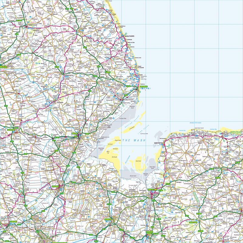
ऑर्डनान्स सर्वेक्षण हे ग्रेट ब्रिटनसाठी राष्ट्रीय मॅपिंग एजन्सी आहे आणि हे जगातील सर्वात मोठे नकाशे उत्पादकांपैकी एक आहे. हे युनायटेड किंगडमच्या सरकारचे गैर-मंत्रिस्तरीय सरकारी विभाग, कार्यकारी संस्था आणि व्यापार निधी आहे, जेथे ते व्यवसायासाठी विभाग, नवे तंत्रज्ञान आणि कौशल्य यांच्या अंतर्गत येते. हे सार्वजनिक डेटा गटचेही एक सदस्य आहे. एजन्सीचे नाव त्याच्या मूळ लष्करी कारणावरून सूचित करते: 1745 मध्ये जेकोबेटच्या बंडाच्या पार्श्वभूमीवर स्कॉटलंडची मॅपिंग करणे. नेपोलियन युद्धांमध्ये आक्रमण होण्याची संभाव्य धोक्याची प्रकाशझोत यामुळे अधिक सामान्य आणि राष्ट्रव्यापी गरज देखील होते. एजन्सीच्या लोगोमध्ये विभाग चे विस्तृत बाण. ऑर्डनन्स सर्वे मॅपिंग सहसा "मोठ्या प्रमाणावरील" किंवा "लहान प्रमाणात" म्हणून वर्गीकृत केले जाते. सर्वेक्षणातील मोठ्या प्रमाणावरील मॅपिंगमध्ये नकाशे सहा इंच ते मैल किंवा त्याहून अधिक आहेत आणि 1 9 80 च्या दशकाच्या सुरुवातीस ते डिजिटल पद्धतीने निश्चित केल्यावर उपलब्ध होते. छोट्या प्रमाणावरील मॅपिंगमध्ये सहा मैल पेक्षा कमी मैलवर नकाशे असतात, जसे की मैल "लेजर" नकाशे आणि त्यांच्या मेट्रिक उत्तराधिकारासाठी लोकप्रिय एक इंच. हे अद्याप पारंपरिक पत्रक फॉर्ममध्ये उपलब्ध आहेत. Ordnance Survey is the national mapping agency for Great Britain and is one of the world's largest producers of maps. It is a non-ministerial government department, executive agency and trading fund of the Government of the United Kingdom, where it falls under the remit of the Department for Business, Innovation and Skills. It is also a member of the Public Data Group. The agency's name indicates its original military purpose: mapping Scotland in the wake of the Jacobite rebellion in 1745. There was also a more general and nationwide need in light of the potential threat of invasion during the Napoleonic Wars, reflected in the inclusion of the War Department's broad arrow in the agency's logo. Ordnance Survey mapping is usually classified as either "large-scale" or "small-scale". The Survey's large-scale mapping comprises maps at six inches to the mile or more and was available as sheets until the 1980s, when it was digitised. Small-scale mapping comprises maps at fewer than six inches to the mile, such as the popular one inch to the mile "leisure" maps and their metric successors. These are still available in traditional sheet form.

इंग्रजी शब्दकोशातील Ordnance Survey व्याख्या

शब्दकोशात ऑर्डनन्स सर्वेची परिभाषा म्हणजे ब्रिटिश किंवा आयरिश सरकारची अधिकृत नकाशा बनविणारी संस्था.

The definition of Ordnance Survey in the dictionary is the official map-making body of the British or Irish government.

इंग्रजी शब्दकोशातील «Ordnance Survey» ची मूळ व्याख्या पाहण्यासाठी क्लिक करा.
मराठी मधील व्याख्येचे स्वयंचलित भाषांतर पाहण्यासाठी क्लिक करा.

इंग्रजी चे शब्द जे ORDNANCE SURVEY सारखे सुरू होतात

Ordinary National Diploma
ordinary rating
ordinary ray
ordinary seaman
ordinary shares
ordinate
ordinately
ordination
ordinee
ordnance
Ordnance Corps
ordnance datum
ordnance factory
Ordnance Survey map
ordo
ordonnance
Ordovician
ordure
ordurous
Ordzhonikidze

इंग्रजी चे शब्द ज्यांचा ORDNANCE SURVEY सारखा शेवट होतो

aerial survey
attitude survey
damage survey
dialect survey
dispurvey
Garvey
Geological Survey
Harvey
jarvey
kurvey
opinion survey
presurvey
purvey
resurvey
sample survey
spot survey
structural survey
survey

इंग्रजी च्या शब्दकोशामधील समानार्थी शब्दाच्या Ordnance Survey चे समानार्थी शब्द आणि विरुद्धार्थी शब्द

समानार्थी शब्द

25 भाषांमध्ये «Ordnance Survey» चे भाषांतर

भाषांतरकर्ता
online translator

ORDNANCE SURVEY चे भाषांतर

आमच्या इंग्रजी बहुभाषी भाषांतरकर्त्यासह Ordnance Survey चे 25 भाषांमधील भाषांतर शोधा.
या विभागात सादर केलेल्या इंग्रजी चा Ordnance Survey इतर भाषेतली भाषांतरे स्वयंचलित सांख्यिकीय भाषांतराद्वारे प्राप्त झाली आहेत; जिथे आवश्यक भाषांतर युनिट इंग्रजी चा «Ordnance Survey» हा शब्द आहे.

भाषांतरकर्ता इंग्रजी - चीनी

地形测量
1,325 लाखो स्पीकर्स

भाषांतरकर्ता इंग्रजी - स्पॅनिश

Ordnance Survey
570 लाखो स्पीकर्स

इंग्रजी

Ordnance Survey
510 लाखो स्पीकर्स

भाषांतरकर्ता इंग्रजी - हिन्दी

आयुध सर्वेक्षण
380 लाखो स्पीकर्स
ar

भाषांतरकर्ता इंग्रजी - अरबी

مسح الذخائر
280 लाखो स्पीकर्स

भाषांतरकर्ता इंग्रजी - रशियन

Картографическое
278 लाखो स्पीकर्स

भाषांतरकर्ता इंग्रजी - पोर्तुगीज

Ordnance Survey
270 लाखो स्पीकर्स

भाषांतरकर्ता इंग्रजी - बंगाली

অর্ডিন্যান্স সার্ভে
260 लाखो स्पीकर्स

भाषांतरकर्ता इंग्रजी - फ्रेंच

Ordnance Survey
220 लाखो स्पीकर्स

भाषांतरकर्ता इंग्रजी - मलय

Kajian Ordnance
190 लाखो स्पीकर्स

भाषांतरकर्ता इंग्रजी - जर्मन

Landesvermessungsamt
180 लाखो स्पीकर्स

भाषांतरकर्ता इंग्रजी - जपानी

武器調査
130 लाखो स्पीकर्स

भाषांतरकर्ता इंग्रजी - कोरियन

병기 조사
85 लाखो स्पीकर्स

भाषांतरकर्ता इंग्रजी - जावानीज

Survey Ordnance
85 लाखो स्पीकर्स
vi

भाषांतरकर्ता इंग्रजी - व्हिएतनामी

Ordnance Survey
80 लाखो स्पीकर्स

भाषांतरकर्ता इंग्रजी - तमिळ

ஆர்.எஸ்.எஸ்
75 लाखो स्पीकर्स

भाषांतरकर्ता इंग्रजी - मराठी

आयुध सर्वेक्षण
75 लाखो स्पीकर्स

भाषांतरकर्ता इंग्रजी - तुर्की

Mücadele Anketi
70 लाखो स्पीकर्स

भाषांतरकर्ता इंग्रजी - इटालियन

Ordnance Survey
65 लाखो स्पीकर्स

भाषांतरकर्ता इंग्रजी - पोलिश

Ordnance Survey
50 लाखो स्पीकर्स

भाषांतरकर्ता इंग्रजी - युक्रेनियन

картографічне
40 लाखो स्पीकर्स

भाषांतरकर्ता इंग्रजी - रोमानियन

Ordnance Survey
30 लाखो स्पीकर्स
el

भाषांतरकर्ता इंग्रजी - ग्रीक

Η Ordnance Survey
15 लाखो स्पीकर्स
af

भाषांतरकर्ता इंग्रजी - अफ्रिकान्स

Ordnance Survey
14 लाखो स्पीकर्स
sv

भाषांतरकर्ता इंग्रजी - स्वीडिश

Ordnance Survey
10 लाखो स्पीकर्स
no

भाषांतरकर्ता इंग्रजी - नॉर्वेजियन

Ordnance Survey
5 लाखो स्पीकर्स

वापराचे कल Ordnance Survey

कल

संज्ञा «ORDNANCE SURVEY» वापरण्याच्या प्रवृत्ती

0
100%
वारंवारता
बर्याच प्रमाणात वापरले
80
/100
वर दर्शविलेला नकाशा वेगवेगळ्या देशांमध्ये «Ordnance Survey» या संज्ञेच्या वापराची वारंवारता देते.
मुख्य शोध प्रवृत्ती आणि Ordnance Survey चे सामान्य वापर
आमच्या इंग्रजी ऑनलाइन शब्दकोशामध्ये आणि «Ordnance Survey» या शब्दासह सर्वात विस्तृत प्रमाणात वापरल्या जाणार्या अभिव्यक्तीमध्ये प्रवेश करण्यासाठी वापरकर्त्यांनी केलेल्या प्रमुख शोधांची सूची.

«ORDNANCE SURVEY» या संज्ञेचे कालावधीमध्ये वापरण्याची वारंवारता

गेल्या 500 वर्षांच्या दरम्यानची «Ordnance Survey» या शब्दाच्या वापराच्या वारंवारतेची वार्षिक उत्क्रांती आलेख व्यक्त करतो. वर्ष 1500 आणि सध्याच्या दिवसामध्ये इंग्रजी मधील डिजिटल केलेल्या मुद्रित स्त्रोतांमध्ये किती वरचेवर «Ordnance Survey» ही संज्ञा दिसून येते त्याच्या विश्लेषषणावर त्याची अंमलबजावणी आधारित आहे.

Ordnance Survey बद्दल इंग्रजी तील साहित्य, कोट्स आणि बातम्या मधील वापराची उदाहरणे

उदाहरणे

«ORDNANCE SURVEY» संबंधित इंग्रजी पुस्तके

खालील ग्रंथसूची निवडीमध्ये Ordnance Survey चा वापर शोधा. इंग्रजी साहित्यामध्ये वापराचा संदर्भ देण्यासाठी Ordnance Survey शी संबंधित पुस्तके आणि त्याचे थोडक्यात उतारे.
1
Map Of A Nation: A Biography Of The Ordnance Survey
Map of a Nation tells the story of the creation of the Ordnance Survey map – the first complete, accurate, affordable map of the British Isles.
Rachel Hewitt, 2011
2
Index to Ordnance Survey Memoirs of Ireland Series: People ...
Finally available, this is an indispensable index to the magnificent forty volume series that is the 1830-1840 Ordnance Survey Memoirs of Ireland.
Patrick McWilliams, 2002
3
Map Addict: A Tale of Obsession, Fudge and the Ordnance Survey
They are the unsung heroes of life, and this guide sings their song. There are some fine, dry tomes out there about the history and development of cartography: this is not one of them.
Mike Parker, 2010
4
Ordnance Survey: fifth report of session 2007-08, report, ...
the fact that Ordnance Survey is required to fund both its Public Task and commercial work entirely from its own revenues makes it difficult to define precisely where its public duty ends and its competition with private operations begins. l4.
Great Britain: Parliament: House of Commons: Communities and Local Government Committee, 2008
5
Ordnance Survey Memoirs of Ireland: Vol. 13: Parishes of ...
This volume contains the Memoirs for 10 parishes and granges in county Antrim, and takes us on a journey from the coastal towns of Glenarm and Carnlough up through Cushendall and the fabled Glens, inland towards Loughguile in the west, and ...
Angélique Day, Patrick McWilliams, 1992
6
Planning maps published by the Ordnance Survey on a scale of ...
Great Britain. Ordnance Survey, Great Britain. Ministry of Housing and Local Government, Great Britain. Dept. of Health for Scotland. H NOTE ON THE SERIES PLANNING MAPS These maps of Great Britain are produced in two sheets, are on ...
Great Britain. Ordnance Survey, Great Britain. Ministry of Housing and Local Government, Great Britain. Dept. of Health for Scotland, 1958
7
Ordnance Survey Memoirs of Ireland
In these new editions they act as a 19th century Domesday book and are essential to the understanding of the cultural heritage of their communities.
Angélique Day, Patrick McWilliams, 1991
8
The Irish Ordnance Survey: History, Culture and Memory
This is a cultural and intellectual history of the Ordnance Survey, which mapped Ireland from 1824 to 1846.
Gillian M. Doherty, 2006
9
Ordnance Survey Memoirs of Ireland: Vol. 15: Parishes of Co. ...
This volume contains the Memoirs for the town and extensive parish of Dungiven in the Upper Roe Valley.
Angélique Day, Patrick McWilliams, 1992
10
Ordnance Survey Memoirs of Ireland: Vol. 11: Parishes of Co. ...
This volume contains the Memoirs for the parishes of Aghanloo, Dunboe, and Magilligan, a coastal region in the lower Roe Valley of county Londonderry which includes the important seat of Down Hill.
Angélique Day, Patrick McWilliams, 1991

नवीन गोष्टी ज्यामध्ये «ORDNANCE SURVEY» ही संज्ञा समाविष्ट आहे

खालील बातम्यातील आयटमच्या संदर्भात राष्ट्रीय आणि आंतरराष्ट्रीय पत्रकार कशाबद्दल बोलले आहेत आणि Ordnance Survey ही संज्ञा कशी वापरली आहे ते शोधा.
1
Go walk: Kingdom come, with little effort - Crohane Mountain, Co Kerry
Map: Ordnance Survey. Discovery Series. Sheet 79. Start & finish: At the junction of a boreen and the third-class road that leads from the N22 to ... «Irish Times, जुलै 15»
2
Cork's vintage 'high-status' home hits the market at €1.2m
The house dates from around 1750 and the historical Ordnance Survey maps indicate it was previously known as Malmaison. This might have ... «Irish Independent, जुलै 15»
3
Minecraft: Exeter and East Devon painstakingly recreated
Inspired by the famously detailed Ordnance Survey map of Great Britain, The British Geological Society has painstakingly reproduced the ... «Exeter Express and Echo, जुलै 15»
4
Josiah Mortimer :Relocation, Relocation, Relocation: Where Should …
Ordnance Survey put this point in 2000 as Lindley Hall Farm in Leicestershire, near the larger cities of Leicester and Coventry. • A touring ... «Huffington Post UK, जुलै 15»
5
Fascinating tale of forgotten Thatto Heath history
After research in ordnance survey maps and press cuttings from the Liverpool mercury, he began to put together the story, of which there seemed to be little ... «St Helens Star, जुलै 15»
6
Modern Artist Angela Palmer on Sculpting From Science
As for mapping, it is an area which has long captivated me, starting with ordnance survey maps in geography lessons at school. There's a ... «Inverse, जुलै 15»
7
Geovation programme helps kick-start start-ups
The Geovation Programme, which runs out of Ordnance Survey's recently opened Geovation Hub, offers developers, innovators and ... «E&T magazine, जुलै 15»
8
OGC seeks sponsors for FutureCities Pilot
Ordnance Survey, a Strategic Member of the OGC, has long used open standards and contributed to their development. As one of the sponsors ... «DirectionsMag.com, जुलै 15»
9
North Devon recreated in Minecraft
The map is crafted using Ordnance Survey data and soil material data which has been translated into the basic Minecraft blocks including ... «North Devon Journal, जुलै 15»
10
On the right path with OS Maps
Ordnance Survey has produced a new off-road sat-nav style router in its OS Maps application that covers Britain's 15 National Parks. «GISuser.com, जुलै 15»
संदर्भ
« EDUCALINGO. Ordnance Survey [ऑनलाइन]. उपलब्ध <https://educalingo.com/mr/dic-en/ordnance-survey>. मे 2024 ».
अ‍ॅप डाउनलोड करा educalingo
en
इंग्रजी शब्दकोश
वरील शब्दांमध्ये लपलेले सर्व शोधा