Muat turun aplikasi
educalingo
Cari

Maksud "Ordnance Survey map" dalam kamus Corsica

Kamus
KAMUS
section

SEBUTAN ORDNANCE SURVEY MAP DALAM CORSICA

Ordnance Survey map  [ˈɔːdnəns ˈsɜːveɪ mæp] play
facebooktwitterpinterestwhatsapp

KATEGORI TATABAHASA ORDNANCE SURVEY MAP

kata nama
adjektif
kata kerja
kata sifat kerja
kata ganti nama
kata depan
konjungsi
penentu
seru

APAKAH MAKSUD ORDNANCE SURVEY MAP dalam CORSICA?

Klik untuk melihat definisi asal «Ordnance Survey map» dalam kamus Corsica.
Klik untuk melihat terjemahan automatik definisi dalam Melayu.
Ordnance Survey map

Kajian Ordnance

Ordnance Survey

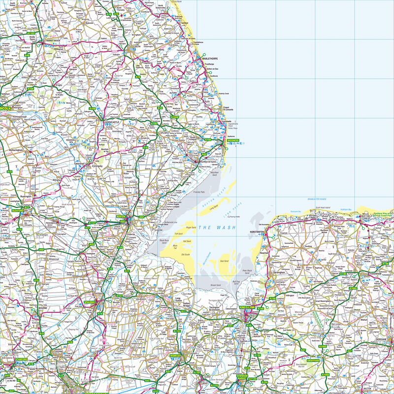
Survey Ordnance adalah agensi pemetaan negara untuk Great Britain dan merupakan salah satu pengeluar peta terbesar di dunia. Ia adalah jabatan kerajaan non-menteri, agensi eksekutif dan dana perdagangan Kerajaan United Kingdom, di mana ia berada di bawah peruntukan Jabatan Perniagaan, Inovasi dan Kemahiran. Ia juga merupakan ahli Kumpulan Data Awam. Nama agensi menunjukkan tujuan ketenteraan asalnya: pemetaan Scotland berikutan pemberontakan Jacobite pada 1745. Terdapat juga keperluan yang lebih umum dan nasional memandangkan potensi ancaman pencerobohan semasa Perang Napoleon, yang tercermin dalam kemasukan Perang Anak panah luas Jabatan di logo agensi. Pemetaan Survey Ordnance biasanya diklasifikasikan sebagai "skala besar" atau "skala kecil". Pemetaan besar-besaran Survey terdiri daripada peta pada enam inci hingga batu atau lebih dan boleh didapati sebagai hela sampai tahun 1980-an, apabila ia didigitalkan. Pemetaan skala kecil terdiri daripada peta pada kurang daripada enam inci hingga batu, seperti satu inci yang popular untuk peta "rekreasi" batu dan pengganti metrik mereka. Ini masih boleh didapati dalam bentuk lembaran tradisional. Ordnance Survey is the national mapping agency for Great Britain and is one of the world's largest producers of maps. It is a non-ministerial government department, executive agency and trading fund of the Government of the United Kingdom, where it falls under the remit of the Department for Business, Innovation and Skills. It is also a member of the Public Data Group. The agency's name indicates its original military purpose: mapping Scotland in the wake of the Jacobite rebellion in 1745. There was also a more general and nationwide need in light of the potential threat of invasion during the Napoleonic Wars, reflected in the inclusion of the War Department's broad arrow in the agency's logo. Ordnance Survey mapping is usually classified as either "large-scale" or "small-scale". The Survey's large-scale mapping comprises maps at six inches to the mile or more and was available as sheets until the 1980s, when it was digitised. Small-scale mapping comprises maps at fewer than six inches to the mile, such as the popular one inch to the mile "leisure" maps and their metric successors. These are still available in traditional sheet form.

Definisi Ordnance Survey map dalam kamus Corsica

Takrif Peta Ukur Ordnance dalam kamus adalah peta topografi rasmi kawasan di United Kingdom.

The definition of Ordnance Survey map in the dictionary is an official topographical map of an area in the United Kingdom.

Klik untuk melihat definisi asal «Ordnance Survey map» dalam kamus Corsica.
Klik untuk melihat terjemahan automatik definisi dalam Melayu.

CORSICA PERKATAAN YANG BERIMA DENGAN ORDNANCE SURVEY MAP


bitmap
ˈbɪtˌmæp
IMAP
ˈaɪˌmæp
map
mæp
photomap
ˈfəʊtəʊˌmæp
remap
riːˈmæp

CORSICA PERKATAAN YANG BERMULA SEPERTI ORDNANCE SURVEY MAP

Ordinary National Diploma
ordinary rating
ordinary ray
ordinary seaman
ordinary shares
ordinate
ordinately
ordination
ordinee
ordnance
Ordnance Corps
ordnance datum
ordnance factory
Ordnance Survey
ordo
ordonnance
Ordovician
ordure
ordurous
Ordzhonikidze

CORSICA PERKATAAN YANG BERAKHIR SEPERTI ORDNANCE SURVEY MAP

chromosome map
cognitive map
contour map
digital map
electoral map
genetic map
grid map
mud map
off the map
outline map
put on the map
relief map
road map
route map
site map
skeleton map
sketch map
street map
weather map

Sinonim dan antonim Ordnance Survey map dalam kamus sinonim Corsica

SINONIM

Terjemahan «Ordnance Survey map» ke dalam 25 bahasa

PENTERJEMAH
online translator

TERJEMAHAN ORDNANCE SURVEY MAP

Cari terjemahan Ordnance Survey map kepada 25 bahasa dengan penterjemah Corsica pelbagai bahasa kami.
Terjemahan Ordnance Survey map dari Corsica ke bahasa lain yang dibentangkan dalam bahagian ini telah diperolehi menerusi terjemahan statistik automatik; di mana unit terjemahan penting adalah perkataan «Ordnance Survey map» dalam Corsica.

Penterjemah Corsica - Cina

全国地形测量局地图
1,325 juta pentutur

Penterjemah Corsica - Czech

Artillería mapa Encuesta
570 juta pentutur

Corsica

Ordnance Survey map
510 juta pentutur

Penterjemah Corsica - Hindi

आयुध सर्वेक्षण नक्शा
380 juta pentutur
ar

Penterjemah Corsica - Amhara

الذخائر خريطة المسح
280 juta pentutur

Penterjemah Corsica - Rusia

Картографическое карте
278 juta pentutur

Penterjemah Corsica - Punjabi

Ordnance mapa Levantamento
270 juta pentutur

Penterjemah Corsica - Basque

অর্ডিন্যান্স সার্ভে মানচিত্র
260 juta pentutur

Penterjemah Corsica - Frisia

Ordnance Survey carte
220 juta pentutur

Penterjemah Corsica - Melayu

Peta Ukur Ordnance
190 juta pentutur

Penterjemah Corsica - Chichewa

Messtischblatt
180 juta pentutur

Penterjemah Corsica - Jepun

兵器調査マップ
130 juta pentutur

Penterjemah Corsica - Kreol Haiti

병기 조사 지도
85 juta pentutur

Penterjemah Corsica - Jerman

Peta Survey Ordnance
85 juta pentutur
vi

Penterjemah Corsica - Vietnam

Bản đồ khảo sát bom mìn
80 juta pentutur

Penterjemah Corsica - Tagalog

ஆர்.எஸ்.எஸ்
75 juta pentutur

Penterjemah Corsica - Marathi

आयुध सर्वेक्षण नकाशा
75 juta pentutur

Penterjemah Corsica - Turki

Donanma Anketi haritası
70 juta pentutur

Penterjemah Corsica - Itali

Ordnance Survey mappa
65 juta pentutur

Penterjemah Corsica - Poland

Ordnance Survey mapie
50 juta pentutur

Penterjemah Corsica - Ukraine

Картографічне мапі
40 juta pentutur

Penterjemah Corsica - Romania

Ordnance harta Sondaj
30 juta pentutur
el

Penterjemah Corsica - Cina

Ordnance Survey χάρτη
15 juta pentutur
af

Penterjemah Corsica - Afrikaans

Ordnance Survey kaart
14 juta pentutur
sv

Penterjemah Corsica - Swahili

Ordnance Survey karta
10 juta pentutur
no

Penterjemah Corsica - Parsi

Ordnance Survey kartet
5 juta pentutur

Aliran kegunaan Ordnance Survey map

ALIRAN

KECENDERUNGAN PENGGUNAAN TERMA «ORDNANCE SURVEY MAP»

0
100%
KEKERAPAN
Kerap digunakan
69
/100
Peta yang ditunjukkan di atas memberikan kekerapan penggunaan terma «Ordnance Survey map» dalam negara berbeza.
Kecenderungan carian utama dan penggunaan umum Ordnance Survey map
Senarai carian utama yang dibuat oleh pengguna untuk mengakses kamus Corsica dalam talian kami dan ungkapan yang paling banyak digunakan dengan perkataan «Ordnance Survey map».

KECENDERUNGAN PENGGUNAAN TERMA «ORDNANCE SURVEY MAP» DARI MASA KE MASA

Grafik menyatakan evolusi tahunan kekerapan penggunaan perkataan «Ordnance Survey map» selama 500 tahun yang lalu. Pelaksanaannya adlah berdasarkan kepada menganalisa kekerapan istilah «Ordnance Survey map» muncul dalam sumber bercetak digital dalam Corsica antara tahun 1500 dan hari ini.

Contoh penggunaan dalam kesusasteraan Corsica, petikan dan berita mengenai Ordnance Survey map

CONTOH

CORSICA BUKU YANG BERKAIT DENGAN «ORDNANCE SURVEY MAP»

Ketahui penggunaan Ordnance Survey map dalam pilihan bibliografi berikut. Buku yang berkait dengan Ordnance Survey map dan ekstrak ringkas dari yang sama untuk menyediakan konteks penggunaannya dalam kesusasteraan Corsica.
1
Map Of A Nation: A Biography Of The Ordnance Survey
Map of a Nation tells the story of the creation of the Ordnance Survey map – the first complete, accurate, affordable map of the British Isles.
Rachel Hewitt, 2011
2
Geographical Enquiries: Skills and Techniques for Geography
1.1 Ordnance Survey map of Otmoor (1 :50,000) Most Ordnance Survey maps that are used are either at a 1:50,000 or a 1:25,000 scale. On a 1:50,000 map 1cm on the map relates to 50,000cm on the ground. On a 1:25,000 map every 1cm on ...
Garrett Nagle, Kris Spencer, 2000
3
Townlands in Ulster: Local History Studies
THE IMPORTANCE OF MAPS In this investigation our starting date should be the present and we should begin with a close and thorough examination of the district using first the latest edition of the Ordnance Survey map and then the Revised ...
W. H. Crawford, R. H. Foy, 1998
4
Geological Maps: Their Solution and Interpretation
031 557 3011. The Ordnance Survey Map Catalogue is available from: Ordnance Survey, Romsey Road, Southampton S09 4DH. Tel. 0703 792398 or 792416. example on Map 3 the symbols indicate that all the subdivisions present belong to ...
T. Bolton, 1989
5
Geographic Information Management in Local Government
Aerial photgraphy provides high-quality aerial photographs, an integral part of the Ordnance Survey map revision system. • Landplan is the map of choice for site location, farm or estate management, and identifying land use at 1:10,000 scale.
Ian Gilfoyle, Peter Thorpe, 2004
6
Survey of Medieval Winchester
The prime cartographic source for this present Survey has been the Ordnance Survey Map at 1:500 scale surveyed in 1869-71 and probably first published during the two years following the completion of the survey (Frontispiece II b).s This ...
Derek Keene, Alexander R. Rumble, 1985
7
The Woodland Heritage Manual
Without knowing where a certain earthwork or area of coppice wood is located, it cannot be managed and preserved. Grid references can be derived in several ways. • Directly from an Ordnance Survey map if the feature has already been ...
Ian D. Rotherham, Melvyn Jones, Lindy Smith, 2011
8
na
Ordnance Survey map Ordnance Survey maps are accepted for registration only in cases where such maps are the current edition of the largest scale published. Dimensioned plans of large-scale surveys are accepted for registration only in ...
9
World Mapping Today
The 1:50 000 and 1:25 000 scale topographic maps are available from Ordnance Survey map agents in the UK and from LSD, Grand Cayman, while digital maps in hard copy or on disk, CD-ROM or tape may also be purchased from the latter.
Bob Parry, Chris Perkins, 2000
10
Headingley: 'this Pleasant Rural Village' ; Clues to the Past
1850: Ordnance Survey Map (surveyed 1847) (6 inches to the mile). 1890: Large Scale (10feettothe mile) Ordnance Survey Town Map (surveyed 1889) –sheets in the CCIII13 series cover parts of Headingley. 1893: Ordnance Survey Map ...
Eveleigh Bradford, 2008

BARANGAN BERITA YANG TERMASUK TERMA «ORDNANCE SURVEY MAP»

Ketahui apa yang diterbitkan oleh akhbar nasional dan antarabangsa dan cara istilah Ordnance Survey map digunakan dalam konteks perkara berita berikut.
1
Minecraft: Exeter and East Devon painstakingly recreated
Inspired by the famously detailed Ordnance Survey map of Great Britain, The British Geological Society has painstakingly reproduced the ... «Exeter Express and Echo, Jul 15»
2
From the BT Tower to Lyons Corner Houses, a lament for lost …
... was an official secret, and therefore appeared on no Ordnance Survey map for all that it was 191 metres high and built of concrete and steel. «The Guardian, Jul 15»
3
Council launches 'adopt a path' scheme in Burnham-On-Sea area
Anyone can get involved in the project. You can check if a route you wish to adopt is a public right of way by checking an Ordnance Survey map ... «Burnham-On-Sea, Jul 15»
4
Walkers guide helicopter to injured friend
The group were well prepared and were able to give a good location using an Ordnance Survey map reference and visual marks such as being ... «Stoke Sentinel, Jul 15»
5
Air ambulance called to 22-year-old with dislocated knee at Thor's …
The group were well prepared and were able to give a good location using an Ordnance Survey map reference and visual marks such as being ... «Ashbourne News Telegraph, Jul 15»
6
July 14: Third Energy insist Ryedale fracking application has not …
These ranged from a spelling error in an address to the fact that the current Ordnance Survey map for Ryedale does not show a recent ... «Yorkshire Post, Jul 15»
7
The Guardian view on rambling: the right to roam is a precious …
The Big Pathwatch aims to persuade participants to take a single square kilometre of an ordnance survey map and walk every recorded path ... «The Guardian, Jul 15»
8
Hunting lodge in buyers' sights
Moycullen House is described as having been built in 1890, although it's not on the second-edition Ordnance Survey map, that area having ... «Irish Independent, Jul 15»
9
Misery for drivers as no end in sight for for £22million Taunton road
That is despite an Ordnance Survey map showing of the town showing the route of the road dotted in with a note saying it would open in ... «Somerset County Gazette, Jul 15»
10
OLD POND WELCOMES YOUNG PEOPLE IN RYDE
The 1863 Ordnance Survey map shows three ponds in the vicinity. One where the existing pond still is, but it was twice the size it is now. One to ... «Island Echo, Jul 15»
RUJUKAN
« EDUCALINGO. Ordnance Survey map [dalam talian]. <https://educalingo.com/ms/dic-en/ordnance-survey-map> Tersedia. Mei 2024 ».
Muat turun aplikasi educalingo
en
Kamus Corsica
Temui semuanya yang tersembunyi dalam perkataan di
indeks
a b c d e f g h i j k l m n o p q r s t u v w x y z