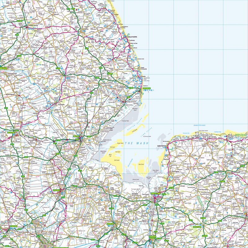
与 «ORDNANCE SURVEY MAP»相关的英语书籍
在以下的参考文献中发现
Ordnance Survey map的用法。与
Ordnance Survey map相关的书籍以及同一来源的简短摘要提供其在 英语文献中的使用情境。
1
Map Of A Nation: A Biography Of The
Ordnance Survey
Map of a Nation tells the story of the creation of the Ordnance Survey map – the first complete, accurate, affordable map of the British Isles.
2
Geographical Enquiries: Skills and Techniques for Geography
1.1 Ordnance Survey map of Otmoor (1 :50,000) Most Ordnance Survey maps
that are used are either at a 1:50,000 or a 1:25,000 scale. On a 1:50,000 map
1cm on the map relates to 50,000cm on the ground. On a 1:25,000 map every
1cm on ...
Garrett Nagle, Kris Spencer, 2000
3
Townlands in Ulster: Local History Studies
THE IMPORTANCE OF MAPS In this investigation our starting date should be the
present and we should begin with a close and thorough examination of the
district using first the latest edition of the Ordnance Survey map and then the
Revised ...
W. H. Crawford, R. H. Foy, 1998
4
Geological Maps: Their Solution and Interpretation
031 557 3011. The Ordnance Survey Map Catalogue is available from: Ordnance
Survey, Romsey Road, Southampton S09 4DH. Tel. 0703 792398 or 792416.
example on Map 3 the symbols indicate that all the subdivisions present belong
to ...
5
Geographic Information Management in Local Government
Aerial photgraphy provides high-quality aerial photographs, an integral part of
the Ordnance Survey map revision system. • Landplan is the map of choice for
site location, farm or estate management, and identifying land use at 1:10,000
scale.
Ian Gilfoyle, Peter Thorpe, 2004
6
Survey of Medieval Winchester
The prime cartographic source for this present Survey has been the Ordnance
Survey Map at 1:500 scale surveyed in 1869-71 and probably first published
during the two years following the completion of the survey (Frontispiece II b).s
This ...
Derek Keene, Alexander R. Rumble, 1985
7
The Woodland Heritage Manual
Without knowing where a certain earthwork or area of coppice wood is located, it
cannot be managed and preserved. Grid references can be derived in several
ways. • Directly from an Ordnance Survey map if the feature has already been ...
Ian D. Rotherham, Melvyn Jones, Lindy Smith, 2011
Ordnance Survey map Ordnance Survey maps are accepted for registration only
in cases where such maps are the current edition of the largest scale published.
Dimensioned plans of large-scale surveys are accepted for registration only in ...
The 1:50 000 and 1:25 000 scale topographic maps are available from Ordnance
Survey map agents in the UK and from LSD, Grand Cayman, while digital maps
in hard copy or on disk, CD-ROM or tape may also be purchased from the latter.
Bob Parry, Chris Perkins, 2000
10
Headingley: 'this Pleasant Rural Village' ; Clues to the Past
1850: Ordnance Survey Map (surveyed 1847) (6 inches to the mile). 1890: Large
Scale (10feettothe mile) Ordnance Survey Town Map (surveyed 1889) –sheets in
the CCIII13 series cover parts of Headingley. 1893: Ordnance Survey Map ...
包含词语«ORDNANCE SURVEY MAP»的新条目
找出国内和国际出版社所讨论的内容,以及词语
Ordnance Survey map在以下新条目的上下文中是如何使用的。
Minecraft: Exeter and East Devon painstakingly recreated
Inspired by the famously detailed Ordnance Survey map of Great Britain, The British Geological Society has painstakingly reproduced the ... «Exeter Express and Echo, 七月 15»
From the BT Tower to Lyons Corner Houses, a lament for lost …
... was an official secret, and therefore appeared on no Ordnance Survey map for all that it was 191 metres high and built of concrete and steel. «The Guardian, 七月 15»
Council launches 'adopt a path' scheme in Burnham-On-Sea area
Anyone can get involved in the project. You can check if a route you wish to adopt is a public right of way by checking an Ordnance Survey map ... «Burnham-On-Sea, 七月 15»
Walkers guide helicopter to injured friend
The group were well prepared and were able to give a good location using an Ordnance Survey map reference and visual marks such as being ... «Stoke Sentinel, 七月 15»
Air ambulance called to 22-year-old with dislocated knee at Thor's …
The group were well prepared and were able to give a good location using an Ordnance Survey map reference and visual marks such as being ... «Ashbourne News Telegraph, 七月 15»
July 14: Third Energy insist Ryedale fracking application has not …
These ranged from a spelling error in an address to the fact that the current Ordnance Survey map for Ryedale does not show a recent ... «Yorkshire Post, 七月 15»
The Guardian view on rambling: the right to roam is a precious …
The Big Pathwatch aims to persuade participants to take a single square kilometre of an ordnance survey map and walk every recorded path ... «The Guardian, 七月 15»
Hunting lodge in buyers' sights
Moycullen House is described as having been built in 1890, although it's not on the second-edition Ordnance Survey map, that area having ... «Irish Independent, 七月 15»
Misery for drivers as no end in sight for for £22million Taunton road
That is despite an Ordnance Survey map showing of the town showing the route of the road dotted in with a note saying it would open in ... «Somerset County Gazette, 七月 15»
OLD POND WELCOMES YOUNG PEOPLE IN RYDE
The 1863 Ordnance Survey map shows three ponds in the vicinity. One where the existing pond still is, but it was twice the size it is now. One to ... «Island Echo, 七月 15»


