10 ENGLISH BOOKS RELATING TO «ARAKAN YOMA»
Discover the use of
Arakan Yoma in the following bibliographical selection. Books relating to
Arakan Yoma and brief extracts from same to provide context of its use in English literature.
1
The Asian Elephant: An Action Plan for Its Conservation
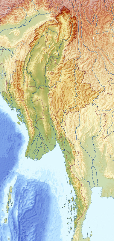
Ten biogeographic regions of Burma. 1. North Kachin. 2. South Kachin and
Upper Chindwin. 3. Chin Hills. 4. Lower Chindwin. 5. Shan Plateau. 6. Arakan
Yoma. 7. Dry Zone. 8. Pegu Yoma. 9. Irrawaddy Delta. 10. Tenaserim. caught (
Caughley ...
Charles Santiapillai, Peter Jackson, IUCN/SSC Asian Elephant Specialist Group, 1990
2
Field Days: A Naturalist's Journey Through South and ...
Arakan Yoma forms part of the mountain arc in western Myanmar, lying between
the Arakan coast and the Irrawaddy valley. The arc extends northward for about
950 km — from Cape Negrais (in Myanmar) to Manipur (in India) — and includes
...
3
Historical Dictionary of Burma (Myanmar)
The Arakan Yoma separates the state from central Burma. The state's major river,
the Kaladan, reaches the sea at Sittwe. The state is a major grower of rice, and
the abundance of paddy explains the rise of early kingdoms in the region. Fishing
...
4
Seventeenth-century Burma and the Dutch East India Company, ...
If, for whatever reason, north Burma was denied access to the coast, as was the
case during much of the f1fteenth century, its ruby trade was rerouted over the
Arakan Yoma. This trade again passed through southern Burma towards the end
of ...
5
A Manual of the Geology of India: Chiefly Compiled from the ...
VL] ROCKS OF THE ARAKAN YOMA. 145 at the frontier, where it extends for
fifteen miles from east to west, and terminating in a point to the southward, west-
by-north of Prome.1 The remainder of the rocks forming the Arakan Yoma,
excluding ...
Geological Survey of India, Henry Benedict Medlicott, William Thomas Blanford, 1893
6
A Complete Course In Certificate Geography
These are the Patkoi Bum in the north, Manipur, Naga, Chin and Mizo hills in the
middle and the Arakan Yoma in the south. The Arakan Yoma goes upto the
shores of the Bay of Bengal. These mountains form a barrier of densely forested ...
7
Discovery of North-East India: Geography, History, Cutlure, ...
Within this district lies the Taungup Pass,86 which runs across the Arakan Yoma
Range and connects Taungup (in the Sandoway district) with Padaung in the
Prome district of Lower Burma. In 1826 this Pass was reported by Lieutenant ...
Suresh Kant Sharma, Usha Sharma, 2005
8
Discover Geography Class - 8 (revised)
The Patkoi Bum, Lushai, Arakan Yoma, Pegu Yoma, Mizo and Naga Hills are the
highlands among which the 'Seven Sisters' of the northeast are located. Patkoi,
Lushai and Arakan Yoma forms the boundary between India and Myanmar.
the Himalaya is a simple curve convex towards the direction of the compressional
force, the Naga Hills and Arakan Yoma with the Andamans and Nicobars form a
well-marked double S-shaped curve. It is difficult to say precisely when the ...
the Himalaya is a simple curve convex towards the direction of the compressional
force, the Naga Hills and Arakan Yoma with the Andamans and Nicobars form a
well-marked double S-shaped curve. It is difficult to say precisely when the ...
Herbert Thirkell White, 2011
10 NEWS ITEMS WHICH INCLUDE THE TERM «ARAKAN YOMA»
Find out what the national and international press are talking about and how the term
Arakan Yoma is used in the context of the following news items.
Earthquake: What tectonic map reveals for Bangladesh
"The Bengal foredeep is a submontane foredeep of the Arakan Yoma geosynclines that entered the organic stage of its development in the ... «Financial Express Bangladesh, Jun 15»
Bangladesh in gravest threat of earthquake
... system in the north, the Burmese Arc and Arakan Yoma anticlinorium in the east, and the Naga Disang Haflong thrust zone in the northeast. «DhakaTribune, Apr 15»
Opium Turns Hillside Town Into 'Widow Village'
The rugged top of the Arakan Yoma mountain range bulges through the center of Chin State, the poorest, sparsest and least connected of ... «The Irrawaddy News Magazine, Jan 15»
Myanmar: the new centre of the world
Most of the Indians (my father and his family, like many other Indians, had trekked back across the Arakan Yoma mountain range back to India ... «Livemint, Jun 13»
Rohingya miss boat on development
The Arakan Yoma and other mountain ranges dominate the region, leaving only a sliver of land between them and sea, much of it little more ... «Asia Times Online, Nov 12»
Who are the Rohingya Muslims?
While the Arakan Yoma mountain range creates a formidable barrier with the rest of Burma, Arakan is separated from the Chittagong region of ... «PakistanToday.com.pk, Aug 12»
No place like home
... Arakan is separated from Bengal only be the Naaf river while it is separated from the rest of Burma by the lofty Arakan Yoma mountain range. «The Economist, Aug 12»
Quake alert: Warning bells for Kolkata buildings
The second zone that can impact Kolkata is called the Arakan Yoma Subduction. "Here the Indian plate juts into the Burma plate and an ... «Times of India, Apr 12»
Jailed Burmese refugees: 'We came here for freedom'
However, Arakan Yoma Mountain separates the Arakanese Maghs from the parent stock. Though descended from the same stock, worshipping ... «Green Left Weekly, Mar 11»
Wikileaks: N. Korea helping build military site in Burma
... 300 North Koreans are working at a secret construction site west of Mimbu, Magway Division, in the foothills of the Arakan Yoma mountains." «Jerusalem Post, Dec 10»